Fun at the Tea Party Museum, or Simba (King George III) and Scar (Samuel Adams) Visit Boston Harbor

Select your language to auto-translate:

EnglishEspañolFrançaisDeutschItalianoDansk中文(简体)中文(漢字)日本語한국어PortuguêsTürkçeالعربية

The Boston Tea Party Museum is a fun, entertaining, educational, hour-long historical extravaganza. It provides a good overview of Revolutionary-era Boston history, a climb-aboard visit to a recreated tea-ship (complete with simulated tea chest tossing), the chance to see one of two remaining tea chests from the fateful night (pretty cool), holographic-enhanced reenactments of key events and personalities, and a ten minute film of the events of April 18-19th, 1775 (Paul Revere’s Ride, the battles of Lexington & Concord, and the “Shot Heard ‘Round the World”). Good fun, but unless you crave Disney-style entertainment or are purchasing a package that includes the Museum, it is pricey.

Is it worth the time and expense? Does Boston need Disneyesque historical entertainment? Is the Tea Party “The single most important event leading up to the American Revolution?” Read on…

The Visit

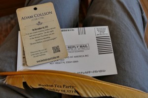
Boston Tea Party Museum New Identity Card

Boston Tea Party Museum Identity Card

Once you arrive at the museum and have a ticket, you are invited to join the next available tour queue. Tours run every ½ hour and can be pretty full in the summer, so when it’s busy you may want to arrive ½ hour before your desired start. You are then ushered into the “Meeting House” and given a card by a colonial-garbed actor. The card holds the pseudo-identity of an actual revolutionary-era citizen (you may be asked to read a line from card later). Once the meeting starts, and in great in theatrical fashion, your guides explain events leading up to the Tea Party.

[Note that you are kept moving from station to station – there is not much time to linger or explore; virtually every step is choreographed. The guides are well trained, personable, and happy to answer questions, but they speak quickly; pay attention as it is easy to miss something.]

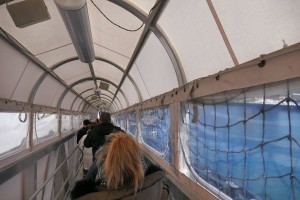
Boston Tea Party Museum Ramp

Boston Tea Party Museum Ramp

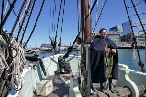
Leaving the Meeting House, you proceed down a gangplank to visit one of the replica tea ships. The replicas are close to the actual Tea Party ships and are amazing. On board, you learn more about the ships and their context, then go below deck to experience what life aboard was like – very tight quarters for the eight men who lived aboard, and these must have been awful in rough seas.

Boston Tea Party Museum Ship Deck

Boston Tea Party Museum Ship Deck

(Click for a wonderful Boston Globe video on the recreation of the ships.)

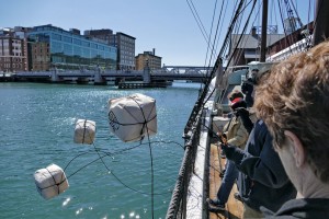
Boston Tea Party Museum Tea Toss

Boston Tea Party Museum Tea Toss

To make it more interactive for the kids, simulated chests of tea are heaved overboard. (A full tea chests weighed well over 300 pounds.)

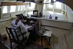
Boston Tea Party Museum Ship Captains Quarters

Boston Tea Party Museum Ship Captains Quarters

On exiting the ships, and while waiting on the dock for your group’s turn to enter the museum, your guide provides additional context to the events and personalities.

Entering the museum, the first stop is a short holographic reenactment of a conversation between two colonial women – one with patriot, and the other with loyalist leanings. The technology is impressive, but the content seems more for show than substance.

The next room houses the Robinson Half Chest. This half chest (a half-chest contained about 100 pounds) was found by teenager John Robinson the morning after the Tea Party. It remained a Robinson family heirloom until it was purchased by the folks who run the museum. After viewing and learning about the chest, visitors turn around and view a holographic-enhanced conversation between the portraits of King George III and Samuel Adams. This is technically innovative and fun, but a little over the top. The pre-recorded reenactors are entertaining, and what they say is true to the history, but a lot is taken out of context.

The last room, the Minuteman Theater, shows a +/- 10 minute film, “Let it Begin Here,” that dramatizes the events of April 18 and 19, 1775. The film wraps around the audience and is complete with air puffs to simulate musket balls flying by. The tie in is that these events were directly as result of the Tea Party. The reenactments are good and historically accurate, the layout and feel of Lexington Green is particularly good; but the portrayal of the participants is overdone and stilted – the actor portraying John Hancock in Lexington is particularly amusing. (Click for an excerpt.)

After the film, you are encouraged to partake in refreshments at Abigail’s Tea Room & Terrace and visit the Gift Shop, which is stocked with every revolutionary-themed tchotchke imaginable. The only thing missing was the chance to purchase a photo of the visitors with a smiling Samuel Adams reenactor.

Historical Accuracy and Quality

Quite good. The Museum provides a solid and largely accurate overview of the events leading up to the Tea Party and the American Revolution as well as useful context of life in this period. The recreation of the tea ships alone is a marvel and worth the visit.

That being said, the events and people are simplified and hyperbolized – both for effect and to pump up the presentation of the Tea Party as “The single most important event leading up to the American Revolution.” No doubt, the Tea Party was a very key event. But it is not the entire story.

I realize that everyone loves a myth with a hero and a villain (Cinderella vs Evil Queen Grimhilde?) – here Samuel Adams vs King George III. But reality is always more nuanced, and the museum makes only anemic attempts to balance their presentation. While this is not necessarily bad, and perhaps even appropriate for a theatrically-themed venue, it is misleading. Suitable for Orlando or Las Vegas, I had hoped Boston might be more thoughtful, or visitors given time to ponder a counterpoint.

Value

Normal admission is $25 for adults, $15 for children – which means a family of four would pay $80 for a one hour show, not including the encouraged refreshments and souvenirs.

Is it worth it? It depends how much you value this type of entertainment. If cash is tight, there are many better values in town – such as the free Freedom Trail Tours run by the National Park Service, a visit and climb through Old Ironsides, the modestly priced visits to the Old State House or Old South Meeting House, or the behind the scenes visits to King’s Chapel or Old North Church, just to name a few.

If you are considering a visit, a much better deal can be found bundled with the purchase of a ticket from the hop-on-off Old Town Trolley (trolleytours.com), which includes admission to the Tea Party Museum. Historic Tours of America owns both the Tea Party Museum and Old Town Trolley, and they also offer packages with admission to the Aquarium, Fenway Park, and other Boston sites that might be on your short list. Check online as tickets are available at a discount.

The Verdict

I had fun and found it worth my time. My visit was fun, participative, educational, and entertaining.

Is it a “must see?” IMHO, it doesn’t fit that category as there are many other places where you will learn and experience more, are more authentic, and are much better values. If I was bringing children, I would weight it a little more positively as its technology and interactivity will hold a child’s attention and memory more than some other sites; but still not in the must see category.

But I had fun, Huzzah!

The Coming of the Europeans – Early Exploration of New England

Select your language to auto-translate:

EnglishEspañolFrançaisDeutschItalianoDansk中文(简体)中文(漢字)日本語한국어PortuguêsTürkçeالعربية

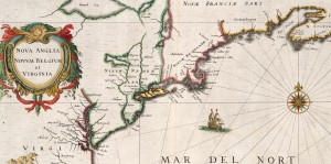
Extracted from 1632 Map of North America - source Map reproduction courtesy of the Norman B. Leventhal Map Center at the Boston Public Library

Extracted from 1632 Map of North America – source Map reproduction courtesy of the Norman B. Leventhal Map Center at the Boston Public Library

This is Part 2 of a series about the founding of New England. For Part 1, the Native Americans, click here.

In the 1400’s, even before Christopher Columbus’s fabled voyage to “discover” America, Basque fisherman commonly fished for cod in the area around what was to be called Newfoundland. In 1497, under the aegis of English King Henry VII, the Genovese explorer Giovanni Caboto (John Cabot), while searching for a spice route to Asia, noted a land with a vast, rocky coastline teeming with cod. Cabot called this “New Found Land,” and claimed it for England. By the early 1500’s, it was common for English fishing ships to visit and harvest the cod from this area.

In parallel efforts, in 1501 the Portuguese explorer Gaspar Corte-Real reached what is now the state of Maine and abducted over 50 Native Americans; the Native Americans were sold into slavery. In 1523 the Italian Giovanni da Verrazano sailed into Narragansett Bay, near present-day Providence, RI, and spent over two weeks trading as a guest of the Natives. After leaving Narragansett, he sailed north and encountered the Abnacki on the coast of Maine. In 1534, Frenchman Jacques Cartier “discovered” and explored the mouth of the St. Lawrence river, claiming the area for France. (Cartier was later involved in colonization efforts, but these were abandoned in 1543.)

By the end of the 1500’s, European exploration in North America had become common, but was focused on fishing the plentiful cod. Permanent settlements did not exist and the fisherman-explorers went home as winter approached. Universally, the Europeans noted that North America was thickly settled with natives, generally described as handsome and healthy. And, the area seemed ripe for exploitation. European attention began to shift to the more systematic capitalization of North America. This resulted in the emergence of “trading companies” set up to establish permanent settlements to harvest the riches.

In 1602, English explorer Bartholomew Gosnold established a small post on Cuttyhunk Island (in the Elizabethan Islands near Cape Cod and New Bedford), but had to abandon the outpost as the group had inadequate supplies to last the winter.  During this visit, Gosnold is credited with naming “Cape Cod” and discovering Martha’s Vineyard. (In 1607 Gosnold was involved in the founding of Jamestown, the first permanent English settlement in North America.)

In 1605, French explorer Samuel de Champlain, known as the founder of “New France” in North America, helped to found Port-Royal, the first successful French Settlement in North America. In 1605-1606, he visited Cape Cod with plans to establish a French base. This plan was abandoned after skirmishes with the Natives. In 1608, Champlain founded what is now known as Quebec City, on the Saint Lawrence River in Canada.

Englishman Sir Ferdinando Gorges, the “Father of English Colonization in North America”, was planning to develop settlements in Maine – then considered “the Northern Parte of Virginia.”  In 1605, he was part of the sponsoring group for an expedition sent to explore the area of New England under Captain George Waymouth. During his voyage, Waymouth captured  five Native Americans, who he brought back to England. According to some accounts, one of the captured Indians was Squanto – the same Squanto who was to play a key role in helping the Pilgrims survive their first winter in North America.  After 1605, many English voyages carried one or more Native Americans as guides and interpreters.

In 1606, again initiated by Gorges, the Sagadahoc settlement (also known as Popham) at base of Kennebec near modern Portland, Maine became the first English attempt at colonizing New England.  It was abandoned after only one year.

In 1609, sponsored by the Dutch East India Company to seek a northwest spice passage, English explorer Henry Hudson passed by the Atlantic Coast and up the river that was to bear his name. Hudson claimed a good part of the territory between Virginia and New England for the Dutch. Their first settlement, for fur trading, was established near present day Albany, New York, in 1615. Dutch colonization efforts did not start until 1624, with the land that was to become their capitol, New Amsterdam, not purchased from the Native Americans until 1626.

In 1614, the English explorer Captain John Smith was ordered by the future King Charles I to sail to America to assess commercial opportunities. Smith reached land in present-day Maine and made his way south to Cape Cod, making contact with natives and mapping out the coastline. Smith called the region “New England.”

During the mapping, Smith observed the land that was to become Boston. He noted a tri-capped hilly peninsula with an excellent harbor. The harbor was fed by three rivers and connected to the mainland by a narrow neck across a shallow back bay. Called “Shawmut,” it was important to the natives for an excellent freshwater spring.

This all was setting the scene for the first permanent settlement in New England in 1620, the Pilgrim’s voyage to what became Plymouth. But, that is another story.

New England Before Europeans – the Native Americans

Select your language to auto-translate:

EnglishEspañolFrançaisDeutschItalianoDansk中文(简体)中文(漢字)日本語한국어PortuguêsTürkçeالعربية

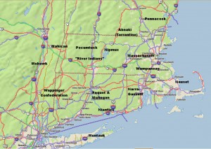
Rough Locations of Primary New England Native American Tribes

Rough Locations of Primary New England Native American Tribes

Map © 2008 DeLorme (www.delorme.com) TOPO USA® – Annotations by the Author

By the time white Europeans arrived, New England had been inhabited by Native Americans for over a thousand years. Migrating here after the retreat of the last ice age, by 1500 they had a population likely in excess of 100,000. Originally hunters and gatherers, they had become more agricultural – with extensive fields of corn (maize), beans, and squash.  By this time the tribes were fundamentally stationary, but shifted dwellings several times year based on weather – winter, autumn hunting, and summer.

The New England tribes had a common heritage and belonged to the Algonquian family. Their language was fairly common, and although each tribe had nuances, there was the ability to be understood from Cape Cod to Canada.

Politically, each tribe and sub-tribe had a single primary ruler, called “sachem” or “sagamore”.  These sachem were usually men, but sometimes there were squaw, or female, sachem.  Within the tribal hierarchy, there were sub-sachems for functions such as the military (for war), powwows (medicine), and other functions.

At the time of the white man’s arrival, there were a number of principle tribes, many peaceful, but some warlike and in competition with their neighbors. The names of these tribes have been inherited by many New England towns, rivers and lakes. Those tribes included:

  • The Abnaki, also known as the Tarrantine to other tribes, inhabited western Maine, especially the Kennebec Androscoggin & Saco River valleys, as well as portions of neighboring New Hampshire. As this is the colder and more mountainous portion of New England, the Abnaki tended more to hunting than farming. More warlike than their southern neighbors, many tribes, and particularly the Massachusetts, lived in dread of Tarrantine raids. They had a reputation for cruelty and were accused of cannibalism by the English.
  • The Penacook inhabited southern and central MA, northeastern MA and southeastern ME, with the principle subdivision around Concord, NH. The Penacook had many subordinate tribes including the Nashua, Piscataqua, and the Winnepesaukee.
  • The Massachusett (in Algonquian, “people of the great hills”), from whom the state of Massachusetts got its name, inhabited the eastern area of state, around Boston. Originally one of the more powerful tribes, it was devastated by the plague and wars with the Abnaki. Their population declined from about 3,000 to 500 between 1615 and 1630.
  • The Wampanoag inhabited the areas of southeastern Massachusetts near where the Pilgrims landed in current Plymouth. They were also devastated by the plague. Metacom (King Philip of “King Philip’s War”) was Wampanoag.
  • The Narragansetts were a powerful tribe that lived in present-day Rhode Island.
  • The Niantics were a largely coastal tribe lived on Narragansett Bay, and extended as far west as the Pequot tribe in Connecticut.
  • The Pequots, of eastern Connecticut were originally part of the Mahican (known as Mohegan, a corruption of the Mahigan name) a tribe of the of upper Hudson River valley in New York.  They were warlike and aggressive and the primary protagonist in the Pequot War in 1637-1638.
  • The Nipmucs who inhabited central MA, were a comparatively weak tribe who frequently paid tribute to their neighbors.
  • The Pocumtucks were a loose association of tribes that lived west of the Nipmucks in the areas around Deerfield, MA.
  • South of the Pocumtucks along the Connecticut River Valley lived the “River Indians”, another loose association of tribes.
  • Bordering the River Indians to the west was the Wappinger Confederacy, which extended from the west bank of the Hudson River as far south as Manhattan and north to Poughkeepsie. Tribes of the Wappinger included the Mattabesic, Quinnipiac, Paugusset, and Tunxis.
  • North of the Wappinger Confederacy were the Mahicans, (Mohecan), the parent tribe to the Pequots. They inhabited the western Connecticut and the upper Hudson Valley in New York.
  • The Nausets were a smaller tribe that lived on Cape Cod.
  • The Montauks inhabited eastern Long Island.
  • The Mohawks, who spanned most of eastern New York State, were the easternmost tribe of the Iroquois confederacy, e.g., they were not Algonquin. Extremely warlike, they were formidable and feared by the Algonquin tribes.

Between 1616 and 1619 a plague, or the “Great Dying,” wiped out almost ¾ of the New England Native American population, with the devastation worse in the coastal areas where mortality was as high as 95%. A major effect was that when white settlers began arriving, starting in 1620, they encountered very little of the indigenous population. The Native American’s ability to resist the Europeans was very weak.

For Part 2, the Early Exploration of New England, click here.

Sources and for additional reading:

Bragdon, Kathleen Joan, Native People of Southern New England, 1500-1650.  University of Oklahoma Press, 1996.

Vaughan, Alden T., New England Frontier Puritans and Indians 1620-1675.  Little Brown and Company Boston, 1965.

http://iweb.tntech.edu/kosburn/History-201/Puritans%20&%20Indians.htm

http://www.memorialhall.mass.edu/classroom/curriculum_6th/lesson2/bkgdessay.html

http://www.smithsonianmag.com/history-archaeology/squanto.htm


Introduction to Lexington Battle Green

Virtually every visitor to historic Lexington will start at the Battle Green, the site of the first fight and the ‘Shot Heard ‘Round the World” on the British’ fateful march to capture Colonial military supplies stored in Concord. This short video provides useful context, military dispositions, and pictures of the attractions on and surrounding Lexington Battle Green. 
Enjoy.
[embedplusvideo height=”300″ width=”450″ editlink=”http://bit.ly/1eWpJmb” standard=”http://www.youtube.com/v/TMrDDcpeG_4?fs=1&hd=1″ vars=”ytid=TMrDDcpeG_4&width=450&height=300&start=&stop=&rs=w&hd=1&autoplay=0&react=1&chapters=&notes=” id=”ep7250″ /]
 

Musket Firing Demo at Minuteman National Historical Park

Attended a wonderful 3.5 hour walk, led by Ranger David Hannigan, of the Battle Road between Concord and Lexington.  When passing by the Hartwell Tavern, we had the opportunity to view this Musket Firing Demo by Ranger Charlie Webster. It was done according to the standard British 1764 Manual of Arms, which was used by both British and Colonial forces.
[embedplusvideo height=”281″ width=”450″ editlink=”http://bit.ly/16CebLT” standard=”http://www.youtube.com/v/1ZzBaBad75Q?fs=1&hd=1″ vars=”ytid=1ZzBaBad75Q&width=450&height=281&start=&stop=&rs=w&hd=1&autoplay=0&react=1&chapters=&notes=” id=”ep8490″ /]

Click for the Minuteman National Historical Park schedule of events. The 3.5 hour Battle Road Walk, wonderful for those interested in detailed Battle information, is given monthly, June through October.

Guide to Boston’s Unique Geography and Changing Landscape

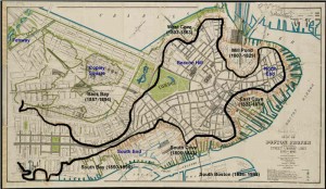
Boston Primary Landfill Projects Since 1775

Annotated 1895 Boston Map Illustrating Landfill Projects

Select your language to auto-translate:

EnglishEspañolFrançaisDeutschItalianoDansk中文(简体)中文(漢字)日本語한국어PortuguêsTürkçeالعربية

One of the most fascinating and overlooked aspects of Boston is how much the land-form has changed over the years.  What you experience today is over 50% landfill.  Places you walk, such as the area around Faneuil Hall, were actually part of the harbor when Boston was founded in 1630.

When the first visitors arrived, they found a salamander-shaped, rocky, hilly, peninsula that was formed by erosion at the end of the last ice age.  Called Shawmut by the Native Americans, it was small, two miles long and only a mile wide.  It’s only connection to the mainland was the low-lying, narrow, wind-swept Boston Neck, which often flooded at high tide and was impassable during stormy weather – meaning the peninsula became an island.  During the siege of Boston, the British troops were effectively blockaded into this tiny island, without adequate food or firewood.

The peninsula was dominated by three hills, hence its early name of Trimountaine, which was later shortened to Tremont – a name that lives on in today’s Tremont Street. There was Copp’s Hill (in the North End), Beacon Hill (which had three summits and was almost twice as high) and Fort Hill (which was located in today’s financial district).

[embedplusvideo height=”365″ width=”450″ standard=”http://www.youtube.com/v/y3QlGzJW27c?fs=1″ vars=”ytid=y3QlGzJW27c&width=450&height=365&start=&stop=&rs=w&hd=0&autoplay=0&react=1&chapters=&notes=” id=”ep8086″ /]


Today’s Boston was created by a series of land reclamation projects, which started in a small way soon after the Puritans arrived in 1630 (you can see the 1630 water line marked in the pavement near the Samuel Adams Statue behind Faneuil Hall).

The major landfill projects took place between 1807 and about 1900, although some reclamation projects extended until almost 2000. Much of the land for the early projects came from the leveling of Fort Hill and from Beacon Hill. The largest project, the filling in of the Back Bay took, spanned several generations between 1856 and about 1894. For that project, gravel was transported in on a specially built train line from Needham, a suburb about nine miles away.  One of the first of the second generation steam shovels was used to fill the gravel cars for the trains, which ran around the clock for almost fifty years.

For a fantastic website, which was used to create the animations in the video above, visit the Boston Atlas. It is simply the best place to play with Boston’s changing topography, and was a great source for this post. Also visit the Norman B. Leventhal Map Center at the Boston Public Library – a wonderful source of historic Boston maps, many of which were used in the creation of this post and the accompanying video.  For those interested in learning more, there is another interesting post from Professor Jeffery Howe at Boston University; for that post, click here.

Gardner Museum – Venice In Boston

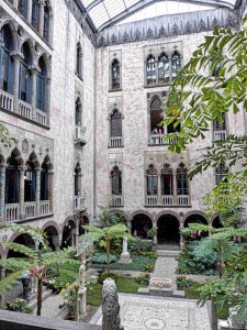
Courtyard at the Gardner Museum

Courtyard at the Gardner Museum

Select your language to auto-translate:

EnglishEspañolFrançaisDeutschItalianoDansk中文(简体)中文(漢字)日本語한국어PortuguêsTürkçeالعربية

For those wishing an amazing and intimate taste of Italy while in Boston, a visit to the Isabella Stuart Gardner Museum is a must. Designed to mimic a 15th century Venetian palace, it was opened by wealthy socialite Isabella Stuart Gardner in 1903 to house her amazing collection of European Art. A meaningful visit can take a little as two hours. For the Gardner’s, website, click here.

Isabella Stuart Gardner was born in 1840 in New York City to a wealthy family and was educated in New York and Paris. In 1860 she married John (“Jack”) Lowell Gardner Jr. and they moved to Boston, Jack’s hometown. After the death of their only child in 1865, the couple traveled extensively in Europe. Their favorite destination became Venice, and they were frequent guests at the Palazzo Barbaro, the home of some fellow Bostonians and a gathering place for artistic of American and English expatriates. The Palazzo Barbaro was to become a major inspiration for the Gardner Museum.

After inheriting a large sum from her father in 1891, Ms. Gardner Isabella began to collect art seriously. She and Jack dreamed of building a museum to hold the collection, which was to grow to over 2,500 pieces – including paintings, sculpture, drawings, manuscripts, ceramics, from all over the world. They were unable to accomplish this together as Jack died in 1898.

Soon after the conclusion of the filling in of Boston’s Back Bay, Isabella Gardner purchased land for the museum and, with architect Willard T. Sears, designed a museum that would evoke a 15th century Venetian palace. The museum opened to the public in 1903. Mrs. Gardner occupied a 4th floor apartment above the museum until her death in 1924. She left an endowment of $1 million that stipulated that the collection be permanently exhibited substantively in the manner that she left it. This is what you visit today.

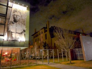
Gardner Museum Nighttime View

Gardner Museum Nighttime View – Old & New

Perhaps the greatest treasure is the old building itself. Certainly, the art, sculpture and other objects are important and fascinating. But, strolling the building, gazing at sculptures and flowers in the pink-hued central courtyard (supplied from their own greenhouses), the substantial yet ethereal sensations you get walking the medieval halls, is a close as one can get Venice and old Europe in the Americas. It is a unique and accessible opportunity.

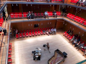
Boston Gardner Museum's Calderwood Hall

Calderwood Hall at Boston’s Gardner Museum

In 2012 an expansion wing opened, presenting a surprising contrast to the old building. Visitors enter through the new wing – while there, make sure to walk up the stairs and take a quick look at the Gardner’s unique concert venue, Calderwood Hall. Seating only 300 people across four levels, concert goers are never more than one row back from the performers; the acoustics are superb. For concert information, click here – if you can, plan early as concerts are often sold out.


Cambridge, Lexington & Concord: Freedom Trail Day Trips

Select your language to auto-translate:

EnglishEspañolFrançaisDeutschItalianoDansk中文(简体)中文(漢字)日本語한국어PortuguêsTürkçeالعربية


Cambridge

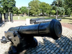
British Cannon on Cambridge Common

British Cannon on Cambridge Common

Cambridge, capitalized as “Newe Town” in 1632, is about five miles up the Charles River from Boston. It was established soon after Boston’s Puritan settlers arrived to provide a safe haven in event of an attack on the coastal Boston. The original village was located at the first convenient river crossing west of Boston, at what is now Harvard Square. Harvard College was founded here in 1636. The town served as the headquarters for the Patriot troops during the Siege of Boston.

Most tourists will want to visit Harvard University and take in the Revolutionary sites around Harvard Square. The best way to visit the area in a few hours is via a walking tour, which is offered by several companies.

I can recommend those from Cambridge Historical Tours, phone 617.520.4030, website here. The basic 90 minute walk covers the University and general Cambridge history; $12 for adults, $7 for children. For those interested in the Revolutionary-era, add the Tory Row option which extends the walk by ½ hour and costs an additional $3.

There are Free Student-Led & Self-Guided Walking Tours of Harvard Yard available directly from Harvard. For the self-guided tours, click here (includes a PDF map and audio files). For mobile phone versions of the self-guided tour, click here. For information about the free student-led tours, click here.

The Longfellow House, run by the National Park Service, is on Tory Row and is only a short walk from Harvard Square. In addition to being the home of poet Henry Wadsworth Longfellow, it was George Washington’s headquarters during the Siege of Boston. The NPS offers seasonal ranger-led tours, talks, and neighborhood walks. For hours and tour times, access the website here or call 617-876-4491. Admission is free.

Public transportation from Boston is easy and quick via the MBTA Red line to the Harvard Square station.

Lexington & Concord

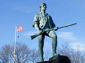
Minuteman Statue on Lexiington Battle Green

Minuteman Statue on Lexington Battle Green

The nearby colonial towns of Lexington and Concord were the sites of the first significant battle of the American Revolution. A visit is highly worthwhile and an easy 1/2 to full day trip from Boston. Each year Massachusetts celebrates Patriots Day, around the April 19th anniversary of the battle, with reenactments and parades at many stops along the battle’s route. For more on the Battles of Lexington and Concord, click here. For a YouTube video intro to Lexington Battle Green, click here.

Most of the Lexington sites center on the Lexington Battle Green, at the site of the first skirmish. For maps and information, start at the Visitor Center, located next to the Battle Green. For Lexington information, click here or call 781-862-1450. There is a downloadable self-guided walking tour of the Battle Green area along with other information from the Lexington Historical Society, to download click here. Call 781-862-1703 to reach the Historical Society directly, website here. The Historical Society runs the Hancock-Clark House, Buckman Tavern, and Munroe Tavern. All offer tours by excellent docents and each offers a unique perspective. The Tourism Committee also runs free tours given by costumed guides, spring through fall . The narrated hop-on/off Liberty Ride, which runs to all the major sites from Lexington to Concord, is a fun way to travel and learn history at the same time.

Important visitor sites close to the Battle Green include the Minuteman Statue (paradoxically, Lexington never had minutemen, only militia), the Buckman Tavern (where the Minutemen gathered just prior to the battle), the Hancock-Clarke House (where Samuel Adams and John Hancock stayed the night before the battle), and the Old Belfry. The Historical Society runs the Hancock-Clark House, Buckman Tavern, and Munroe Tavern. All offer tours by excellent docents and each offers a unique perspective.

Just east of Lexington town center is the Munroe Tavern. The Munroe Tavern was the site of the British headquarters and field hospital during their retreat back to Boston. A packaged ticket for admission to the Munroe Tavern, the Hancock-Clarke House and the Buckman Tavern is available at any of the three houses: $12 for adults and $8 for children 6-16. Individual house admissions are $7 and $5 respectively. Contact the Lexington Historical Society to confirm the operating hours, which vary by season.

Concord was the site of the battle at North Bridge, but if you have time, it has a lot more to offer. For visitor information in the town center, go to the Concord Chamber of Commerce; open from the end of March until late October, and on the Thanksgiving weekend. Walking tours are available; admission is charged. The Chamber can be reached at 978-369-3120; to access their website, click here. To download a walking map of Concord, click here.

Important non-Revolutionary Concord sites include the Orchard House (home of Louisa May Alcott, where she wrote “Little Women;” admission charge), the Concord Museum (which has one of the two lanterns hung at Old North Church; admission charge), and The Wayside (home to the Alcotts, Nathaniel Hawthorne and Margaret Sidney; admission charge).

Most Revolutionary-centric visitors head directly to the Minuteman National Historical Park to visit the area around North Bridge. It is about 1/2 mile from the town center. For more on the Minuteman Park, see below.

For public transportation from Boston to Lexington, take the MBTA Red line to Alewife station and connect with either the #76 or #62 buses to Lexington. The ride from Alewife to Lexington is about 25 minutes. For the MBTA website, click here.

To Concord center, take the MBTA Commuter Rail from Boston’s North Station. The Fitchburg Line train stops at the Concord Depot on Thoreau Street. From the Depot, the North Bridge is a 1.5-mile walk.

For visitors to both Lexington and Concord traveling without cars, the best option is to travel to Lexington and take the Liberty Ride trolley mentioned above. The trolley stops near all major sites in both towns and provides hop-on and off service, giving the opportunity to hike portions of the Battle Road. It runs on weekends in April and May, then daily until October 28. Adult tickets are $25, children 5-17 are $10. It also includes admission to the Lexington houses mentioned above. For Liberty Ride information, call 781 781-862-0500, website here.

Minuteman National Historical Park

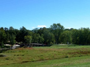
North Bridge from  NPS Visitor Center

North Bridge from NPS Visitor Center

North Bridge seen from the NPS Visitor Center

The Minuteman National Historical Park, run by the National Park Service, has two sections. The eastern section follows the Battle Road from just outside Lexington into Concord. The western section covers the area around North Bridge, just beyond Concord center. Both have visitor centers and ranger-guided tours and talks. All programs are free, with the exception of an admission charge to the Wayside; $5 for adults, free for children 16 and under. For full park information visit the NPS website here or call 978-369-6993. For an interesting website on the Battle Road, click here.

The visitor center at the eastern end of the park (nearest Lexington) features a very good multi-media show, “The Road to Revolution,” especially entertaining for children. The center also has exhibits, dioramas, and other battle-related information. Rangers are on duty to answer questions and there is a small gift shop.

The five mile Battle Road makes for a great hike and much of it has been restored to a state similar to Revolutionary times. Be sure to visit the Hartwell Tavern, which is representative of an authentic period home-tavern and has ranger-programs from May through October. The Paul Revere Capture Site, just off Route 2A, is a frequent visitor stop.

West of Battle Road, and the closest stop to Concord center, is The Wayside. In Revolutionary times, The Wayside was home to the muster master of the Concord Minute Men. Later, it became the “Home of Authors,” with its residents including Louisa May Alcott, Nathaniel Hawthorne, and Harriett Lothrop (Margaret Sidney). As of this update, the Wayside has been closed for renovations. The Wayside is next door to Orchard House, which charges a separate admission fee and is not associated with the Park.

The western section around North Bridge has a small visitor center set spectacularly on the hill overlooking the bridge. It features a few small exhibits and a very good three dimensional map that illustrates the topography of the important battle sites. It is located in a mansion that once belonged to the Buttrick family. Major John Buttrick was the Patriot who ordered the colonials to fire on the British at North Bridge.

For public transportation to the eastern visitor center from Boston, take the MBTA Red line to Alewife station and connect with the #76 bus to the Old Mass Ave & Marrett Road stop in Lexington. Ask the driver to point out the stop. There is no service on Sunday. To the western section, follow the directions to Concord center, above. The Liberty Ride stops at both sections as well as at Hartwell Tavern, Meriam’s Corner, North Bridge and other park sites.

Adams National Historical Park

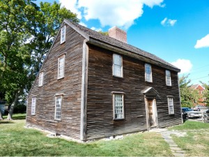
Birthplace of John Adams

Birthplace of John Adams

Birthplace of John Adams

An easy, rewarding, and often-overlooked Freedom Trail side-trip is to the Adams National Historical Park in Quincy. The park includes the homes of American presidents John Adams (the famous Patriot and 2nd US President), his son, John Quincy Adams (the 6th president), and their descendants from 1720 to 1927. The park is right off of the MBTA Red line and is a simple, quick, and inexpensive trip from Boston. The park is open from mid-April until mid-November. Check their website here or call 617-770-1175. For a web-translation of this section, click here.

A visit starts at the NPS visitor center – access to the homes is only permitted via ranger-led tours. Tours run two hours and cost $5 for adults; children under 16 and holders of a National Park America the Beautiful Passes are free. Before leaving the visitor center, view the excellent short film, “Enduring Legacy,” that overviews the Adams’ lives and accomplishments – it is excellent.

The first stop is at the presidents’ birthplaces. To start, you will visit the wonderful, sparse, “saltbox” house (c. 1681) where John was born in 1735. Only 75 feet away is the house where John and Abigail gave birth to John Quincy in 1767. That house also holds the law office where John drafted the Massachusetts Constitution, which later served as the model for the US Constitution.

The next stop is at the “Old House.” Built in 1731, it was purchased by John and Abigail as a more suitable residence after their return from John’s diplomatic posting to London in 1788. The Adams family expanded the home from its original seven rooms to what you visit today. It was also home to John Quincy, his son Charles Francis (ambassador to Great Britain during the Civil War) and their descendants. It served as a summer White House and is full of original family artifacts and art that helps tell the Adams’ story – a real treasure to visit.

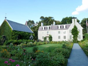
Adams Old House  with Stone Library & Garden

Adams Old House with Stone Library & Garden

Next door to the Old House, set in a beautiful garden, is the Stone Library, built in 1873. This serves as the John Quincy Adams presidential library and holds over 14,000 books, artifacts and family paintings.

Across the street from the visitor center, but not part of the National Park, is the United First Parish Church. The Church contains the tombs of John, Abigail, John Quincy and Louisa Catherine Adams, website here. Founded in 1636 as a branch of the Puritan church in Boston, this is the fourth Church building erected on this site. Designed by Alexander Paris (also designer of Quincy Market), it was completed in 1828, with granite and funding from John Adams. If you have time, take the brief tour of the church and the crypt; a small donation is requested. Tours are available on the same schedule as the National Historical Park, from mid-April through mid-November.

Boston Harbor Islands

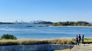
View from Georges Island Artillery Observation Tower

Boston from Georges Island Artillery Observation Tower

A fantastic trip and relaxing change from Revolutionary Boston is a visit to the Harbor Islands National Recreation Area. At the Islands you can visit a Civil War era fort, swim, picnic, hike, bird watch, camp, enjoy a concert, or just delight on the wonderful, narrated cruise through the Harbor. For the younger visitors there is even a playground with an amazing view of the Boston skyline. The Islands are a cooperative effort between the National Park Service and various Commonwealth, City and private groups.

The park itself features 12 islands and peninsulas, and even the oldest active lighthouse station in the United States (used since 1716, only accessible via a special “Lighthouse Tour”); practically, you can visit a maximum of two Islands per day – visiting a single Island requires at least ½ day, but don’t rush. There is a snack shack with a seafood menu on Georges Island, but the food quality can be variable – so you may want to pack a lunch. There is an expertly-staffed pavilion on the Rose Kennedy Greenway between Quincy Market and Long Wharf to help plan your visit, purchase ferry tickets, etc.

Although ferries run from several suburban locations, most visitors will take the ferry the north side of Long Wharf (by Christopher Columbus Park); the ferries take you to either George’s or Spectacle Island. From George’s Island, during the summer, there are connections to other islands. Fares are: Adults, $15; children 4-11, $9; over 65, $11, inter-island, $3. Regular service runs May through Columbus Day in the fall, but there are various winter visit opportunities. Definitely visit the website for current and detailed visiting and transportation information.

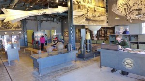
There is a very well done Visitor Center on Georges Island with interpretive exhibits highlighting the Islands’ history, their role in the defense of Boston, the impacts of changing military technology, even the respective diets of enlisted men and officers – fascinating even for the non-military-oriented visitor. Unless you know you want your stop to be Spectacle Island, stop here first, watch the eight minute video and plan the rest of your visit. Rangers are there to help.

There are excellent Ranger-led tours of the Civil War era Fort Warren, which was built between 1833 and 1861 (self-guided tours are also available). During the Civil War, the fort served as a prison for over 1,000 Confederate personnel, the most famous the Confederate Vice President Alexander Stephens. Fort Warren remained active through the Spanish-American War and World War I. During World War II, it was part of the harbor’s defense from German U-boats. Over the years it was modified to accommodate changing cannon technology. It was permanently decommissioned in the 1950’s when guided missiles obsoleted cannon for coastal defense.

A visit is highly recommended and suitable for all ages. Handicap access, however, is limited; please check the website for detailed information.

Useful links for a Boston Harbor Islands visit:

  • The official Boston Harbor Islands website.

  • National Park Service website.

  • National Park Service map of the Islands, download here.

  • Boston Harbor Islands YouTube channel, here.

  • Ferry website.

  • The Boston Harbor Island Alliance website.

Georges Island Visitor Center


Freedom Trail Map & Tour App w/Auto Translate – Free!

Freedom Trail Boston Map & Tour App


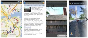
The Freedom Trail Map & Touring App is now available on Google Play as well as Amazon  It is based on the interactive Google Map created for the Freedom Trail Boston – Ultimate Tour Guide – Tips, Secrets & Tricks eBook.

Select your language to auto-translate:

EnglishEspañolFrançaisDeutschItalianoDansk中文(简体)中文(漢字)日本語한국어PortuguêsTürkçeالعربية

The app is much faster and easier to use than the browser version and it exposes all the most powerful features of Google Maps including street mode, local search, directions, and local transportation information. The map itself contains all 16 official Freedom Trail Stops and over 50 additional interesting sites on or close to The Freedom Trail.

An innovative ability for international travelers is the web-based auto-translate feature.  By selecting auto-translate on selected map entries, users with internet-access will access a web site where they can elect to read the entry in Spanish, French, German, Japanese, Mandarin, Korean and other languages.

The app is the perfect companion for planning or when walking The Freedom Trail.

High-Resolution Photos from Freedom Trail Boston – Ultimate Tour & History Guide

Select your language to auto-translate:

EnglishEspañolFrançaisDeutschItalianoDansk中文(简体)中文(漢字)日本語한국어PortuguêsTürkçeالعربية

One of the great frustrations in publishing an eBook is that the publisher is megabyte constrained – e.g., there is an incentive to keep eBooks small.

High resolution photos use up a lot of megs.  So, to keep things small, the photos in the eBook are either 800 x 600 or 640 x 480 and have been compressed. They are illustrative and fine for an eReader, tablet or phone, but this resolution does not do them justice as photographs.

The gallery below contains the photos used in the “Freedom Trail Boston – Ultimate Tour & History Guide – Tips, Secrets & Tricks” eBook in 2048 x 1536 format compressed to +/- .5 meg each.  I’ve also include a few pictures that simply did not fit or that are representative of what you will see on and around the Freedom Trail. If anyone is interested in one in native format, 4000 x 3000 +/- 5 meg each, email me and we’ll figure something out.

Warmest regards,

Steve

What is The Freedom Trail?

Freedom Trail Logo Boston

Welcome to The Freedom Trail

The Freedom Trail is the largest attraction in New England, with over three million visitors a year. It is fun, walkable, accessible, family-friendly, engaging, and a bargain. You can see it in 1/2 a day, or spend several days and still want more.

Select your language to auto-translate:

EnglishEspañolFrançaisDeutschItalianoDansk中文(简体)中文(漢字)日本語한국어PortuguêsTürkçeالعربية

And, Boston has everything you might want in a destination – world class museums, fantastic restaurants, shopping, sports, music, theater and history. It’s a unique and charming place that can feed almost any passion. There are great options for almost any budget, even a bargain lobster lunch.

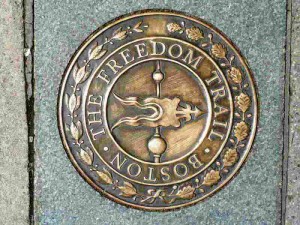
So, what is it? The Freedom Trail is a 2.5 mile red brick path  (mostly brick – some lines are painted) that connects 16 significant historic sites, referred to as “Stops” throughout this blog.  The Trail starts at Boston Common and officially ends at the Bunker Hill Monument in Charlestown.

Most of the Stops are free and many are handicapped accessible, but some may be difficult to navigate for non-walkers. For the few that charge admission, there are discounted tickets available.

The original idea for The Freedom Trail was conceived by William Schofield, a long-time journalist for the now defunct Boston newspaper, the Herald Traveler. In 1951, Schofield had the idea for a walking path that connected Boston’s great collection of local landmarks. With the support of local historians, politicians and businessmen, the Freedom Trail was born.

In addition to the official Stops, there are many “unofficial Stops” you pass as you traverse the Trail, or are very near by. Most unofficial Stops are directly associated with Revolutionary Boston and The Freedom Trail, but some are simply interesting places.  Many folks include them in their Freedom Trail visit.

So, how should you plan for your visit, and for how long? The posts on Planning to Tour, Part 1 and Part 2, will give you an overview of all the official Stops, a sense of how long it takes to visit each, and alternative itineraries for 1/2, full and two day tours. Use this free custom Google Map to help visualize your visit – it is practically a full blown self-touring guide in itself. For a complete view of The Freedom Trail, get a copy of the “Freedom Trail Boston – Ultimate Tour & History Guide – Tips, Secrets & Tricks“.

The influence Boston had on the thinking and actions that led to the American Revolution was extraordinary. Without Boston and its unique history, the American colonies break with Great Britain may have still happened, but not when and how it did. The Freedom Trail presents the essence of Revolutionary Boston and brings its amazing impact to life.

Enjoy, Boston is a unique city and The Freedom Trail is a national treasure.

Freedom Trail Boston Video Virtual Tour in 5 Minutes

A 5 minute comprehensive video walk through of The Freedom Trail, it features all the 16 official Freedom Trail Stops, more than 50 unofficial Stops, historic restaurants, and other interesting places in and around The Freedom Trail – all included in theFreedom Trail Boston – Ultimate Tour Guide – Tips, Secrets & Tricks eBook. It moves fast as it contains almost 150 photos and video segments, so keep your pause key handy if you want to view anything in detail. A must see for anyone visiting The Freedom Trail and Colonial Boston.

The video was created as a companion to the  eBook “Freedom Trail Boston – Ultimate Tour and History Guide,” now available on Amazon.com. The Guide covers all of the sites in the video and more. In addition to any touring information the reader might need, the Guide provides detailed historical context from the time of Boston’s founding through events like the Boston Massacre, the Boston Tea Party, Paul Revere’s Ride, the Battles of Lexington and Concord, and the Charles Bulfinch era. In short, it contains everything someone might want to know to visit and enjoy The Freedom Trail and Revolutionary Boston.

For a companion map to the video, see my custom Google Map posting. The map includes everything in the video.

Enjoy the video!

Boston’s North End – More Than “Little Italy,” A Brief History

Select your language to auto-translate:

EnglishEspañolFrançaisDeutschItalianoDansk中文(简体)中文(漢字)日本語한국어PortuguêsTürkçeالعربية

Most people know the North End as Boston’s Little Italy. But, Italians did not start moving into the North End in any significant number until the 1880’s – some 260 years after the North End’s earliest residents. The Italians were only the last of a series of ethnic groups to inhabit this area of Boston.

Boston's North End

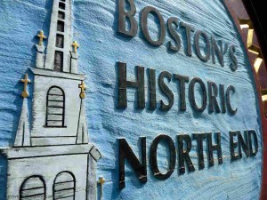
Entering Boston’s Historic North End

Originally, the North End was a suburb for the Puritan families who migrated to Boston during the 1630’s. At that time, the North End was isolated, virtually an island surrounded by water on three sides, connected to the rest of Boston by a small neck of land.

Over time, was the land connecting the North End to Boston was filled-in, but the North End remained geographically isolated until the completion of the Big Dig in 2007. In recent history, and prior to the Big Dig’s completion, easy entry to the North End was blocked by the elevated Central Artery (Route 93).

By the mid 1640’s the North End had evolved into its own distinct community. By 1649, it was large enough to have its own church, the North Meeting House (later called Boston’s Second Church).

In 1659, the North End established its own Burying Ground, Copp’s Hill. Copp’s Hill took its name from William Copp, a shoemaker who had owned once owned the land. Copp’s Hill was also home to a free black population, many of whom are interred in the Burying Ground.

North Square boston

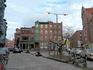
North Square – Looking at Site of Second Meeting House

The area around the North Meeting House developed into North Square, which quickly became the center of North End life. At that time, North Square was only one block from the harbor.

Increase Mather, the minister of the North Meeting House, had his home in North Square. It, along with the Meeting House and a number of surrounding buildings, was destroyed in the fire of 1673. The Meeting House was rebuilt and subsequently torn down by the British and used for firewood during the Siege of Boston between 1775 and 1776.

Paul Revere House in North Square

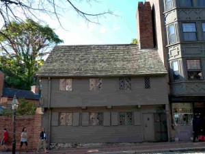
Paul Revere House in North Square

The Paul Revere house was constructed in 1680 where Mather’s home had once stood. Revere purchased it in 1770 and lived here until the 1780’s, when he moved a few blocks away to a house with a harbor view. The Pierce / Hitchborn house, next door to the Revere House, was built around 1711. These houses, along with the Old Corner Book Store and Old State House are the oldest remaining structures in Boston.

The opulent Clark-Frankland and Hutchinson mansions were build just off of North Square after 1710. Hutchinson’s mansion was gutted in 1765 in protest over the Stamp Act. Both the Clark-Frankland and Hutchinson mansions were torn down in 1834 to allow for street widening.

In 1890, Rose Fitzgerald (Kennedy) was born at 4 Garden Court Street, just across the street from where the Hutchinson mansion had stood. Rose later married Joseph P. Kennedy and was the mother of President John F. Kennedy, and Senators Robert and Edward Kennedy. There is a plaque marking the site of her birth on Garden Street just off of North Square. In the mid 1800s, North Square was also home to two Bethels – churches specifically built to minister to the needs of sailors.

Paul Revere & Old North Church

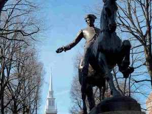
Paul Revere Statue w/View of Old North Church

In 1721, the construction of the Anglican Christ Church (Old North) began and was completed in 1723. In 1775, the Christ Church belfry was used to hang the “two if by sea” lanterns that warned Patriots of the British march on Lexington and Concord and was the start of Paul Revere’s Ride.

The Charles Bulfinch designed New North Congregational Church on Hanover Street was built between 1802 and 1804.  The Church was originally Congregationalist, but it switched to Unitarian in 1813.  It was sold to the Roman Catholic Diocese of Boston in 1862. It is the last Bulfinch designed church standing in Boston.

After the American Revolution, the North End began transitioning to a largely working class neighborhood with the influx of labor associated with the shipping industry. Wharfs and warehouses were built to support maritime trade and shipbuilding. And, along with the often drunken and violent sailors, came the requisite gamblers, whores and criminals. To proper Bostonians, it became a dangerous slum, a place to be avoided.

From early on there was an Irish population in Boston. Their numbers were small, but grew to about 7,000 by 1830. The Irish population really swelled during the Great Potato Famine when a reported 13,000+ Irish moved to Boston during 1847 alone. The North End was their primary destination.

By 1850, over half the North End’s population of 23,000 was Irish. This peaked at about 15,000 in 1880. With the influx of new ethnic groups, many of the Irish moved to the South End. By 1890, North End’s Irish population had dropped to 5,000 and by the turn of the century it was down to 3,000.

In the 1870’s, the North End became home to an Eastern European Jewish population. In the early 1900s, Jews made up almost one third of the North End’s population, many settling along Salem Street. By the 1920’s, most had moved to Boston’s West and South End, then on to Dorchester, Brookline, Newton, Chelsea and Revere.

The last ethnic group to settle in the North End was the Italians. Immigration started in the 1860s with a small group from Genoa. This was followed by and influx from other Italian regions including Sicily, Milan, and Naples. Each regional group settled in its own distinct North End enclave.

By 1900, the North End Italian population had reached 14,000. By 1920, this number grew to 37,000, with its peak of more than 44,000 in 1930. The North End was now almost completely Italian – and very crowded.

The census puts today’s North End population at about 10,000, of which only 40% are of Italian descent. The remaining residents are a mix of young professionals, college students and others. North End politics are still dominated by Italian Americans.

The North End remains Boston’s Little Italy. It retains a wonderful and distinct “Old Word” feeling and boasts fantastic collection of new and old Italian restaurants, cafes, bakeries and markets.  It is one of the most European-feeling neighborhoods in America.

It is the oldest neighborhood in Boston.  Having existed for over 375 years, is home to some of the most important and historic venues in America as well as some of the most significant Freedom Trail sites.

For more historical information, visit this wonderful five part series by Guild Nichols.

Freedom Trail Historic Boston Restaurant Guide & Map


View Freedom Trail Boston – Ultimate Tour Map & Guide in a larger map

For those visiting the Freedom Trail and wishing the immersive experience, there are a number of historic restaurants directly on or close to the Freedom Trail.

The Google Map above displays these restaurants along with the sixteen official Freedom Trail stops and many other interesting sites on or near the Freedom Trail.  It is also available as a free Android app (iPhone/iPad versions to be available soon).

All these restaurants, sites and much is discussed in the eBook “Freedom Trail Boston – Ultimate Tour & History Guide – Tip, Secrets, & Tricks“.

BTW, none of these restaurants should be considered “fine dining,” with the possible exception of the Chart House. But, all are fun and serve good food.  And, they will absolutely enhance your Freedom Trail experience.  Most have excellent lunch specials.  Enjoy!

1654 – Green Dragon Tavern

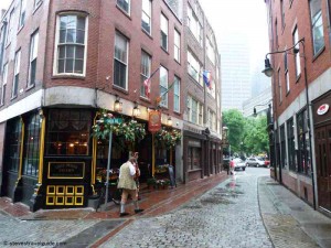
Green Dragon Tavern Boston on Historic Marshall Street

Green Dragon Tavern on Historic Marshall Street

The original Green Dragon Tavern was a around the corner at 84 Union Street. It was founded in 1654 and an active pub by 1714. The Green Dragon was a regular haunt for the Sons of Liberty and the site of the Boston Tea Party planning meetings.  It was torn down in 1828.

The current Green Dragon incarnation is fun and has decent bar food.  It is located on Marshall Street, one of the oldest most authentically historic in Boston.  Right next door is the Ebenezer Hancock House – which built in 1767 by John Hancock’s uncle, inherited by John and then given to his brother, Ebenezer.  Ebenezer became the deputy paymaster to the Continental Army.

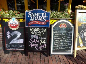
Special at the Green Dragon Tavern Boston

Lobster Specials at the Green Dragon Tavern Boston

Good lunch specials, including lobster.  Everyone needs at least one lobster when visiting Boston!

Green Dragon Tavern website

617-237-2114

1742 (perhaps 1713) – Union Oyster House

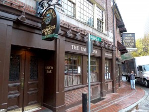
Union Oyster House on Boston Freedom Trail

Union Oyster House

The Union Oyster House started serving in 1826. It is the oldest continuously operating restaurant in the US.  The building, which dates from 1742 (although other references place it as early as 1713), started its life as a dress shop.  At that time, the harbor actually came up to the dress shop’s back door.  Since then, all the land you see has been filled in.

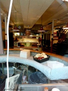
Old Bar at the Union Oyster House

Daniel Webster’s Seat at the Union Oyster House

The legendary Oyster Bar at the front of the restaurant is beautiful and historic.  Regular customer Daniel Webster sat daily at this bar and drank a tall tumbler of brandy and water with each half-dozen oysters – usually eating at least six plates.

Union Oyster House website

617-227-2750

1760 – Chart House

Chart House Restaurant - Hancock's Counting House - 1760

Chart House Restaurant – John Hancock’s Counting House

The Chart House was originally the Gardiner House, built on Long Wharf around 1760. Later, it was John Hancock’s counting house.  It is the oldest building still in use on Long Wharf.

For the pleasant weather, it has outside seating with a great view of the harbor and downtown Boston. It is the most elegant restaurant in this collection.

Chart House website

617-227-1576

1780 – Warren Tavern

Warren Tavern Charlestown - by Bunker Hill

Warren Tavern – by Bunker Hill

Built in 1780, the Warren Tavern was reportedly the first building raised after the British burned Charlestown during the Battle of Bunker Hill in 1775. It is named for Doctor and General Joseph Warren, the famous Patriot who was killed at Bunker Hill. It was visited by George Washington, Paul Revere, and Benjamin Franklin.

Warren Tavern in Charlestown - by Bunker Hill

Warren Tavern – Historic and Good Pub Food by Bunker Hill

Good pub food and great slice of history.

Warren Tavern website

617-241-8142

Freedom Trail Maps with Google Map Tour

Any visitor to the Freedom Trail and Colonial Boston will need good maps.  Here are several – all free.

The Google map below was created for the eBook Freedom Trail Boston – Ultimate Tour and History Guide. In itself, the map is almost a full tour guide and includes the essentials for all the official, as well as many interesting unofficial Freedom Trail sites. All of the Official Stops come with web-based auto-translate links that allow the user to specify the language for the post. A great feature for non-English comfortable users.

The map also provides information such as operating hours, websites, phone numbers, admission costs and handicap access notes.  There are even listings for the best historic restaurants. Here is a video post that includes all the sites listed in the map.

The map is also available as a FREE full-blown Android app, downloadable from Google Play as well as from the Amazon App Store. The app exposes all the best features of Google Maps and is, by far, the most usable way to use the map. It  performs better than using a browser, is much less awkward, and lets you keep the map easily identifiable and ready to launch.

Use it (at your own risk as travel information is subject to change), enjoy it, and please comment.  Pass the link on to your friends.

View Freedom Trail Map & Historic Boston Guide in a larger map


Next is a series of official Freedom Trail maps from the US National Park Service (NPS).  These are savable, printable,  well done and all paid for by US tax dollars.

The main Freedom Trail Map, which is the same that you will see on the NPS Freedom Trail Guide paper guide, is available here.  It is also available from The Freedom Trail Foundation here.  Additionally, there are other relevant visitor maps available from the National Park Service – for the whole series click here.  In addition to the official Freedom Trail map mentioned above, there is a less detailed Freedom Trail map with an outline of Boston’s harbor line at 1775 – fascinating for historical context.  Click here for the 1775 overlay map.  The series also includes maps for the Charlestown Navy Yard,  Boston Harbor in WW II, a map that shows walking distances between Boston sites (Boston is a very walkable city), and a guide for tour bus parking.


Paul Revere, George Washington and John Adams Face to Face at Boston MFA

The Boston Museum of Fine Arts is awesome, and it’s the only place you can see some of the most influential leaders of the American Revolution up close and personal.  John Singleton Copley’s vivid and compelling portraits of Paul Revere, Sam Adams, John Hancock and Joseph Warren are intimate and perceptive.  Gilbert Stuart’s works of George Washington are superb, and you can even see the original portrait used as the model for the U.S. one dollar bill.  This is as close as you can get to shaking hands with these leaders of the American Revolution today.

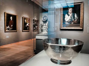
Revere’s Sons of Liberty Bowl with Copley’s Portraits of Revere, Samuel Adams, John Hancock, & Dr. Warren

Located on the first floor of the MFA’s Art of the America’s Wing, the first thing you meet upon entering the gallery is Paul Revere’s 1768 “Son’s of Liberty Bowl.” The silver bowl was commissioned by fifteen members of the Sons of Liberty to honor the Massachusetts House of Representatives for standing up to the British after the Townshend Acts in 1767.  The chain of events set off by the Townshend Acts, and the troops Britain sent to quell the associated Colonial turbulence, was to lead inexorably to the Boston Massacre in 1770 then on to the American Revolution.

The Townshend Acts taxed imported commodities, including paper, glass and tea.  The Massachusetts House of Representatives sent a “Circular Letter” to other colonies asking for their support to protest the Acts – which resulted in boycotts of British goods by Royal colonies.  In Boston, resistance was so intense that British custom officials requested military assistance.  After the HMS Rodney, a 50-gun warship, arrived in Boston harbor, the Colonials rioted and Britain sent 4 regiments of troops to restore order. The presence of the troops led directly to the Boston Massacre.

Directly behind the bowl is Copley’s 1768 portrait of Paul Revere, painted when Revere was thirty three years old.  The portrait was unusual for the period, as it shows Revere without the traditional gentleman’s coat and wig.  (Revere’s family thought it made him look like a workman and actually hid it in the attic.)  The portrait works on many levels, both as a discerning picture of Revere and as a political statement.  Note Revere’s flaunting display of flowing linen shirtsleeves – the linen was manufactured in Boston in direct defiance of British laws.   Flanking the portrait are two cases of Revere’s silver – incredible works of art on their own.

Paul Revere’s Engraving of the Boston Massacre

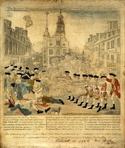
On the wall to the left of Revere’s portrait you will find four important Revolutionary works, one an engraving and three Copley portraits of Boston revolutionaries.  The engraving is Paul Revere’s highly sensationalized depiction of the March 1770 Boston Massacre.  The Massacre took place after an unfortunate chain of events led British soldiers to fire on an angry Boston mob, killing five and wounding six.  Although hardly a massacre (most of the soldiers were later acquitted of blame) it was to be an important event provoking colonial unrest.  The famous engraving you see was a key piece of Patriot propaganda used to help move America closer to its break with Great Britain.

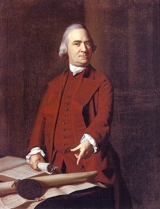
Sam Adams at 50 in 1772

Next is the 1772 portrait of Samuel Adams.  Adams is shown defiantly pointing to a petition from angry Boston citizens after the Boston Massacre.   The portrait was commissioned by John Hancock to hang in his Beacon Street mansion which was located at the southwest corner of the current Massachusetts State House site.

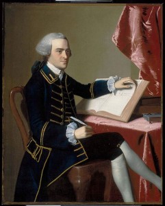
John Hancock at 28 around 1765

Next is John Hancock himself, painted in 1765 when he was twenty-eight.  Hancock is best known for his flamboyant signature on the Declaration of Independence, and he was a multidimensional architect of the Revolution.   A successful merchant, he was one of the richest people in America and personally funded much of the Boston-based dissension.  He was president of the Massachusetts Provincial Congress (the Patriot shadow government that was formed after the Boston Tea Party in 1774), the second Continental Congress, which created the Declaration of Independence, and later served as the first Governor of the State of Massachusetts.

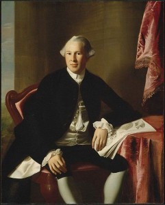
Joseph Warren at 24 around 1765

Further down the wall is the sensitive portrait of Dr. Joseph Warren at the age of twenty-four, also painted around 1765.  Warren was one of the most influential Patriot leaders, and served as President of both the Massachusetts Committee of Safety and the Provincial Congress.   After the April 1775 Battles of Lexington and Concord, he strongly advocated going to war with Britain.  Even though he had limited military experience, he was appointed a major general.  He died fighting as a private during the Battle of Bunker Hill on June 17, 1775.   John Trumbull’s painting “The Death of General Warren at the Battle of Bunker’s Hill” is shown elsewhere in the exhibit.

The exhibition features a number of other Revolutionary-themed works including Copley’s 1796 portrait of John Quincy Adams, the son of John Adams and the sixth President of the United States, and John-Antoine Houdon’s 1789 portrait of Thomas Jefferson.

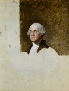
George Washington at 64 “The Athenaeum Portrait” – on the U.S. One Dollar Bill

The next exhibit room features some monumental works by Gilbert Stewart, including the 1796 unfinished portrait of George Washington, known as “The Athenaeum Portrait.”  This painting was used as a model for more than fifty other works, including the image on the U.S. one dollar bill.  Also displayed are Stuart’s portrait of Martha Washington and his idealized 1806 painting of Washington at Dorchester Heights.

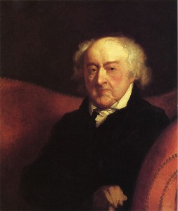
Other Revolutionary works in the same exhibit include Thomas Sully’s 1819 huge painting “The Passage of the Delaware” and Gilbert Stuart’s 1805 painting of General Henry Knox.  General Knox led the expedition that brought the cannons used to lift the Siege of Boston.  He then became chief artillery officer of the Continental Army and later Washington’s Secretary of War.  Stuart’s 1823 portrait of John Adams, ninety at the time of the painting, rounds out the exhibit.  Look into Adams’ tired, sensitive eyes.

Stuart’s John Adams at 90

In all, the five rooms of this gallery contain a treasure of colonial furniture as well as many other important paintings from the 18th and early 19th century colonial America.   Visit and enjoy, whether you are a Revolutionary War enthusiast or not.


Photos of Paul Revere Bowl and Gallery Entrance showing Paul Revere and other Copley portraits, stevestravelguide.com – all rights reserved.

Other pictures from Wikimedia Commons – these works are considered public domain in the United States, and those countries with a copyright term of the life of the author plus 100 years or fewer.


Most Romantic Place in North America

No matter what your definition of romance, Old Quebec City is easily the most romantic getaway destination in North America. It has plenty to do for lovers, families and singles.  Just a little north of New England (about a 7 hour drive from Boston, 4.5 from Burlington VT., or 5.5 hours from Portland ME), any trip to New England could easily include it in the itinerary.  Or, it makes for a great long weekend.


View Quebec City Sites in a larger map
Founded in 1608 and a UNESCO World Heritage Site, Quebec City is as close to being in France as you can get in North America.  If you speak French, and so desire, you will never need to utter a word in English your entire visit.  Getting by with English, however, is not a problem.

It is full of history, quaint hotels and B&B’s, great restaurants, outdoor Parisian-style cafes, fabulous vistas, and wonderful museums for both art and history lovers.  Easy to tour by foot, it is simply one of the best places to spend a few days and a pleasure any time of year.  Be forewarned, it can be very cold in the winter.

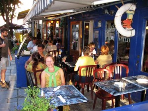
Enjoying a Parisian-Style Cafe in Old Town Quebec

Old Town Quebec consists of Haute-Ville (Upper Town) and Basse-Ville (Lower Town), which also is the location of the old port. I’ll highlight a few of my favorite spots in each.

In Haute-Ville:

The best tour starts by simply walking around. It is small and self contained, beautiful, quaint, there are great places to eat, and is is just a wonderful place to be.  The entire city is surrounded by a stone wall built by both the French and British armies.  In fact it is the only North American city with fortress walls that still exist north of Mexico.  The views overlooking Basse-Ville and the St. Lawrence are excellent.

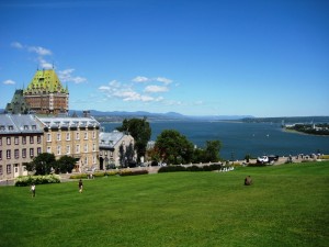
Château Frontenac & the St. Lawrence from the Citadel

Le Château Frontenac is probably the most photographed hotel in North America.  To stay there can be pricey and the property can feel a little stuffy (if you want high-end, as an alternative you may want to consider some of the more intimate, but superb boutique hotels in Basse-Ville like the Dominion or Aberge Saint-Antoine – and both of these are relative bargains), but a martini in the Frontenac’s bar and a guided hotel tour can make the Quebec experience complete.

Plains of Abraham and Citadel from near Musée National

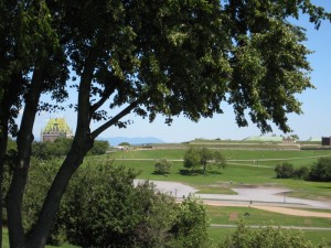
The Plains of Abraham Battlefield Park is a great walk on a nice day. The Plains are the site of the 1759 battle between the French, under Montcalm, and the English, under Wolfe. (Both Montcalm and Wolfe died as a result of wounds received here.)  The battle was deciding moment in the conflict between France and Britain over the fate of New France, and resulted in the turning over of Quebec to the English. The park features beautiful gardens, historic exhibits and great views of the city and the St. Lawrence.  Be sure to visit the Discovery Pavilion for a great overview of the park and its history.  Check for music and festivals during the summer and bring a frisbee.

Le Musée National des Beaux-arts du Québec is a wonderful art museum in the Plains of Abraham Battlefield Park. Housed in three buildings, one of which was the 19th century city prison, it is a great way for art lovers to spend couple of hours. It is home to impressive permanent collections as well as traveling shows.

The Citadel, built between 1820 and 1850 is the largest British fortress built in North America. It features a museum, tours and has a well known changing of the guard ceremony. A must if traveling with children.

In Basse-Ville:

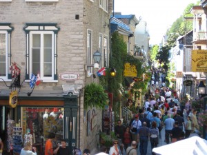
As with Haute-Ville, simply wandering around is a great way to experience the city.  To go between Haute and Basse-Ville, there is the Funiculaire that can be taken up or down if you do not want to navigate the stairs or winding streets, which are steep.  The 17th century architecture and French flavor sets a tone unequaled in North America. There are many places to shop, which range from high-end furs and art to pure kitsch – at your pleasure.  In nice weather, sit outside in a cafe, close your eyes, and when you open them, you are in a French village (truly). Superb!

Rue Souse-le-Fort just below the Frontenac

Musée de la Civilization is an impressive museum dedicated to the history of the world’s peoples. It houses excellent exhibits focused on the humanities, with a concentration on the Canadian people. It is enjoyable by both adults and children.  If it is inclement, this is the best place to spend the day.  The free tours are well done and very insightful.

Le Marché du Vieux-Port de Québec

Le Marché du Vieux-Port de Québec is a wonderful fresh market near the old port and off most tourist agendas.  It is  great place to wander around and pick up supplies for a picnic or to bring back to your hotel room.  Most everything comes from Quebec and the varous stalls specialize in fruits, vegetables, wine, cider, maple products, cheeses, pastries, breads, deli meats, and more.  This is a great place to find non-traditional souvenirs to bring home.

Place-Royale and the Notre Dame des Victoires church

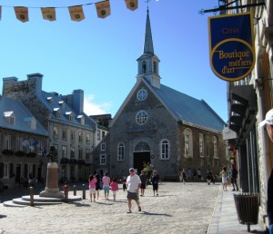
The Place-Royale is where Samuel de Champlain landed in 1608 and founded the first French settlement in North America.  It is an absolutely beautiful square.  Visit the Centre d’Interpretation de Place-Royal for exhibits describing the challenges of setting up a town in the 17th century.  At the end of the square is the Notre Dame des Victoires church, built in 1688 and subsequently destroyed by the British bombardment of 1759.  It has been restored to it’s original character.

Enjoy!!

Lobster Sandwich – Best and Biggest in Boston Area


View Larger Map


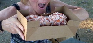
There are few things as wonderful as a lobster sandwich, and this is one of the best. Full of meat, juicy, succulent, decadent, delicious – it is what summer in New England is all about. Absolutely worth the drive, but if your are in the Portsmouth area during a beautiful day, not to be missed. Make sure to ask for it without lettuce to get the maximum heaven.


The Beach Plum is a ice cream stand, and with commercial ice cream at that. But, their lobster and crab sandwiches make the Beach Plum a culinary destination par excellence. There is a seating area with picnic tables and umbrellas at the side of the stand, but the best place to indulge in your feast is on the sea wall across the street overlooking the ocean.

The foot long (pictured) will set you back about $28 (the regular is $17 as of 2010), but is easily enough to share.  A rock crab roll is only $11. The ice cream may not be homemade, but what a great way to end your feast!

A fantastic end to a fantastic day.

Cyrus E. Dallin Art Museum – Arlington

The Cyrus E. Dallin museum is in Arlington Center, just off of Mass Ave at the corner of Mystic Street (Route 60).  The museum houses a wonderful collection of Dallin’s work that spans his wide talents.  Housed in the Jefferson Cutter House, which was built in 1832, it is a great 1-2 hour visit and fascinating for seniors, children and adults alike.


View Larger Map

The Cutter house itself is worth seeing and is the last salt and pepper colonial in Arlington.  Originally owned by the Cutter family, owners of the Cutter Mills, it was moved from near the mill site two miles north of its current location in 1992.  It was made available to the museum by the town in 1998 and in addition to the museum, has some meeting space in the basement where art exhibits are occasionally offered.

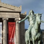
Cyrus Dallin was an important sculptor that moved to Arlington when he was 32 and lived there until his death in 1944.  Well known and connected, many of his works feature Native Americans, but also include statesmen, generals, mythological figures and his family.  Especially worthwhile is a sculpture of his cat – created in a day in response to a taunt from his son.  His iconic “Appeal to the Great Spirit” has been in front of the Museum of Fine Arts in Boston since 1912.   The “Paul Revere Monument” resides in Boston’s North End Paul Revere Mall was famous enough to be parodied by the Marx brothers in Duck Soup.  There is a wonderful sketch by John Singer Sargent of Dallin’s portico.

"Appeal to the Great Spirit" at Boston Muesum of Fine Arts

"Appeal to the Great Spirit" at Boston Museum of Fine Arts

The total collection of about 60 pieces is housed in four intimate rooms.  The docent / curators are superb and very patient and offer wonderful, insightful stories about the art and the man.  Admission is free, but donations are welcomed.  Hours are Wednesday through Sunday 12 to 4PM.

There is on street parking or a large town lot directly behind the museum.  Or, there is bus service from Harvard Square.  There are tons of great restaurants in Arlington well as other tourist sites within an easy walk.  Well worthwhile.  A hidden gem.  Their excellent web site can be accessed at http://dallin.org/

Great Arlington Haunts include:

Punjab Restaurant – Arlington
Thai Moon – Arlington

Cuzco and Machu Picchu Guide

I first visited Cuzco and Machu Picchu as part of a six month trip throughout South America in 1976.  That experience was great.  I saw fantastic places, worked through challenging situations, and learned a lot about myself through experiencing other cultures, the people and their history.  And, I got to spend time and learn from some very interesting and broadening fellow travelers from all over the world.

Wanting my family to experience some of what I did, we traveled to Cuzco and Machu Picchu.  Machu Picchu is one of the “Seven Wonders of World” and is a truly amazing place.  Cuzco is a great colonial city with wonderful Incan and Spanish history.  This was to be our first family trip to a developing country.

I wrote this book when, after our trip, a friend commented “I’ve always wanted to go there, but was intimidated and felt it was too expensive.”  Given that kick, I wrote this ebook.  It answers everything I wanted to know when planning our trip but could not practically find in guide books or on the web.  And, I added tips and experiences learned from the trip that will simplify your trip, making it safer, less expensive and more enjoyable.

Pick it up.  It is an amazing adventure and you can do it.

For the Nook, please visit: http://search.barnesandnoble.com/Steves-Guide-to-Cuzco-and-Machu-Picchu/Steve-Gladstone/e/2940012230997/?itm=1&USRI=machu+picchu%2c+gladstone

Isles of Shoals


View Larger Map
Visiting the Isles of Shoals makes a wonderful day trip out of Portsmouth harbor. Catch a ferry with the Isles of Shoals Steamship Company at 315 Market Street in downtown Portsmouth for the 9 mile ride out the Islands. The Steamship Company offers various excursions that include guided Portsmouth Harbor tours or stops for exploring the islands.

View Larger Map
The cruise out to the islands is a wonderful way to spend a few hours. The narrated ride passes through Portsmouth Harbor, which is beautiful and features history and sites galore. To port (on the Maine side of the Harbor – left on the way out to the islands), you will pass the Portsmouth Naval Shipyard and the abandoned Naval prison. Watch for submarine conning towers that may be visible as you pass by.

To starboard you will pass Fort Constitution at the mouth of the harbor. Fort Constitution is built on the site of Fort William and Mary, which was the site of the true first organized action by the Colonials against the British in 1774 – before Lexington and Concord! On December 13, 1774, Paul Revere (remember him from the Midnight Ride) rode 60 miles from Boston to Portsmouth and informed the The Portsmouth Committees of Safety and Correspondence that a British expedition that was in transit by sea to seize control of the powder and armaments stored at the fort. On the following day, a band of 400 New Hampshire militiamen assaulted the fort, which was manned by just 6 British soldiers. The British managed to fire three cannons at the Colonials, but were quickly overwhelmed. A large amount of gunpowder was captured along with some muskets and cannon. There were no serious injuries, but this was truly the first battle of the American Revolutionary War, a full four months before Concord and Lexington.

Site of Fort William and Mary - First Colonial Action Against British


The ferry will stop at Star IslandStar Island to drop off and pick up passengers. At the island, there is a retreat hotel run by the Unitarian Church. They offer day services including meals and it is possible to spend the night between mid-June and mid-September. The organization runs various retreats, workshops and conferences that run from photography to international affairs to family conferences. The facility is beautiful and a real throwback to the 19th century – Nathanial Hawthorne stayed here. Accommodations are pretty basic, but the location is fantastic. A beautiful and quite place to spend a day or a few nights.