Fun at the Tea Party Museum, or Simba (King George III) and Scar (Samuel Adams) Visit Boston Harbor

Select your language to auto-translate:

EnglishEspañolFrançaisDeutschItalianoDansk中文(简体)中文(漢字)日本語한국어PortuguêsTürkçeالعربية

The Boston Tea Party Museum is a fun, entertaining, educational, hour-long historical extravaganza. It provides a good overview of Revolutionary-era Boston history, a climb-aboard visit to a recreated tea-ship (complete with simulated tea chest tossing), the chance to see one of two remaining tea chests from the fateful night (pretty cool), holographic-enhanced reenactments of key events and personalities, and a ten minute film of the events of April 18-19th, 1775 (Paul Revere’s Ride, the battles of Lexington & Concord, and the “Shot Heard ‘Round the World”). Good fun, but unless you crave Disney-style entertainment or are purchasing a package that includes the Museum, it is pricey.

Is it worth the time and expense? Does Boston need Disneyesque historical entertainment? Is the Tea Party “The single most important event leading up to the American Revolution?” Read on…

The Visit

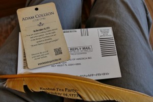
Boston Tea Party Museum New Identity Card

Boston Tea Party Museum Identity Card

Once you arrive at the museum and have a ticket, you are invited to join the next available tour queue. Tours run every ½ hour and can be pretty full in the summer, so when it’s busy you may want to arrive ½ hour before your desired start. You are then ushered into the “Meeting House” and given a card by a colonial-garbed actor. The card holds the pseudo-identity of an actual revolutionary-era citizen (you may be asked to read a line from card later). Once the meeting starts, and in great in theatrical fashion, your guides explain events leading up to the Tea Party.

[Note that you are kept moving from station to station – there is not much time to linger or explore; virtually every step is choreographed. The guides are well trained, personable, and happy to answer questions, but they speak quickly; pay attention as it is easy to miss something.]

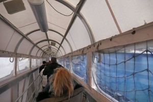
Boston Tea Party Museum Ramp

Boston Tea Party Museum Ramp

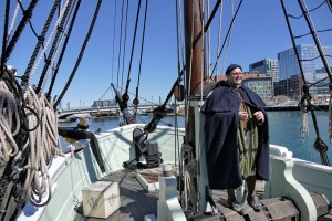
Leaving the Meeting House, you proceed down a gangplank to visit one of the replica tea ships. The replicas are close to the actual Tea Party ships and are amazing. On board, you learn more about the ships and their context, then go below deck to experience what life aboard was like – very tight quarters for the eight men who lived aboard, and these must have been awful in rough seas.

Boston Tea Party Museum Ship Deck

Boston Tea Party Museum Ship Deck

(Click for a wonderful Boston Globe video on the recreation of the ships.)

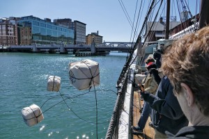
Boston Tea Party Museum Tea Toss

Boston Tea Party Museum Tea Toss

To make it more interactive for the kids, simulated chests of tea are heaved overboard. (A full tea chests weighed well over 300 pounds.)

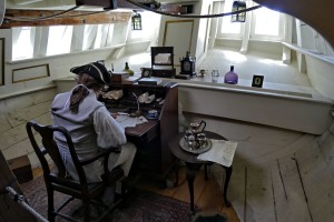
Boston Tea Party Museum Ship Captains Quarters

Boston Tea Party Museum Ship Captains Quarters

On exiting the ships, and while waiting on the dock for your group’s turn to enter the museum, your guide provides additional context to the events and personalities.

Entering the museum, the first stop is a short holographic reenactment of a conversation between two colonial women – one with patriot, and the other with loyalist leanings. The technology is impressive, but the content seems more for show than substance.

The next room houses the Robinson Half Chest. This half chest (a half-chest contained about 100 pounds) was found by teenager John Robinson the morning after the Tea Party. It remained a Robinson family heirloom until it was purchased by the folks who run the museum. After viewing and learning about the chest, visitors turn around and view a holographic-enhanced conversation between the portraits of King George III and Samuel Adams. This is technically innovative and fun, but a little over the top. The pre-recorded reenactors are entertaining, and what they say is true to the history, but a lot is taken out of context.

The last room, the Minuteman Theater, shows a +/- 10 minute film, “Let it Begin Here,” that dramatizes the events of April 18 and 19, 1775. The film wraps around the audience and is complete with air puffs to simulate musket balls flying by. The tie in is that these events were directly as result of the Tea Party. The reenactments are good and historically accurate, the layout and feel of Lexington Green is particularly good; but the portrayal of the participants is overdone and stilted – the actor portraying John Hancock in Lexington is particularly amusing. (Click for an excerpt.)

After the film, you are encouraged to partake in refreshments at Abigail’s Tea Room & Terrace and visit the Gift Shop, which is stocked with every revolutionary-themed tchotchke imaginable. The only thing missing was the chance to purchase a photo of the visitors with a smiling Samuel Adams reenactor.

Historical Accuracy and Quality

Quite good. The Museum provides a solid and largely accurate overview of the events leading up to the Tea Party and the American Revolution as well as useful context of life in this period. The recreation of the tea ships alone is a marvel and worth the visit.

That being said, the events and people are simplified and hyperbolized – both for effect and to pump up the presentation of the Tea Party as “The single most important event leading up to the American Revolution.” No doubt, the Tea Party was a very key event. But it is not the entire story.

I realize that everyone loves a myth with a hero and a villain (Cinderella vs Evil Queen Grimhilde?) – here Samuel Adams vs King George III. But reality is always more nuanced, and the museum makes only anemic attempts to balance their presentation. While this is not necessarily bad, and perhaps even appropriate for a theatrically-themed venue, it is misleading. Suitable for Orlando or Las Vegas, I had hoped Boston might be more thoughtful, or visitors given time to ponder a counterpoint.

Value

Normal admission is $25 for adults, $15 for children – which means a family of four would pay $80 for a one hour show, not including the encouraged refreshments and souvenirs.

Is it worth it? It depends how much you value this type of entertainment. If cash is tight, there are many better values in town – such as the free Freedom Trail Tours run by the National Park Service, a visit and climb through Old Ironsides, the modestly priced visits to the Old State House or Old South Meeting House, or the behind the scenes visits to King’s Chapel or Old North Church, just to name a few.

If you are considering a visit, a much better deal can be found bundled with the purchase of a ticket from the hop-on-off Old Town Trolley (trolleytours.com), which includes admission to the Tea Party Museum. Historic Tours of America owns both the Tea Party Museum and Old Town Trolley, and they also offer packages with admission to the Aquarium, Fenway Park, and other Boston sites that might be on your short list. Check online as tickets are available at a discount.

The Verdict

I had fun and found it worth my time. My visit was fun, participative, educational, and entertaining.

Is it a “must see?” IMHO, it doesn’t fit that category as there are many other places where you will learn and experience more, are more authentic, and are much better values. If I was bringing children, I would weight it a little more positively as its technology and interactivity will hold a child’s attention and memory more than some other sites; but still not in the must see category.

But I had fun, Huzzah!

The Coming of the Europeans – Early Exploration of New England

Select your language to auto-translate:

EnglishEspañolFrançaisDeutschItalianoDansk中文(简体)中文(漢字)日本語한국어PortuguêsTürkçeالعربية

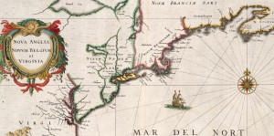
Extracted from 1632 Map of North America - source Map reproduction courtesy of the Norman B. Leventhal Map Center at the Boston Public Library

Extracted from 1632 Map of North America – source Map reproduction courtesy of the Norman B. Leventhal Map Center at the Boston Public Library

This is Part 2 of a series about the founding of New England. For Part 1, the Native Americans, click here.

In the 1400’s, even before Christopher Columbus’s fabled voyage to “discover” America, Basque fisherman commonly fished for cod in the area around what was to be called Newfoundland. In 1497, under the aegis of English King Henry VII, the Genovese explorer Giovanni Caboto (John Cabot), while searching for a spice route to Asia, noted a land with a vast, rocky coastline teeming with cod. Cabot called this “New Found Land,” and claimed it for England. By the early 1500’s, it was common for English fishing ships to visit and harvest the cod from this area.

In parallel efforts, in 1501 the Portuguese explorer Gaspar Corte-Real reached what is now the state of Maine and abducted over 50 Native Americans; the Native Americans were sold into slavery. In 1523 the Italian Giovanni da Verrazano sailed into Narragansett Bay, near present-day Providence, RI, and spent over two weeks trading as a guest of the Natives. After leaving Narragansett, he sailed north and encountered the Abnacki on the coast of Maine. In 1534, Frenchman Jacques Cartier “discovered” and explored the mouth of the St. Lawrence river, claiming the area for France. (Cartier was later involved in colonization efforts, but these were abandoned in 1543.)

By the end of the 1500’s, European exploration in North America had become common, but was focused on fishing the plentiful cod. Permanent settlements did not exist and the fisherman-explorers went home as winter approached. Universally, the Europeans noted that North America was thickly settled with natives, generally described as handsome and healthy. And, the area seemed ripe for exploitation. European attention began to shift to the more systematic capitalization of North America. This resulted in the emergence of “trading companies” set up to establish permanent settlements to harvest the riches.

In 1602, English explorer Bartholomew Gosnold established a small post on Cuttyhunk Island (in the Elizabethan Islands near Cape Cod and New Bedford), but had to abandon the outpost as the group had inadequate supplies to last the winter.  During this visit, Gosnold is credited with naming “Cape Cod” and discovering Martha’s Vineyard. (In 1607 Gosnold was involved in the founding of Jamestown, the first permanent English settlement in North America.)

In 1605, French explorer Samuel de Champlain, known as the founder of “New France” in North America, helped to found Port-Royal, the first successful French Settlement in North America. In 1605-1606, he visited Cape Cod with plans to establish a French base. This plan was abandoned after skirmishes with the Natives. In 1608, Champlain founded what is now known as Quebec City, on the Saint Lawrence River in Canada.

Englishman Sir Ferdinando Gorges, the “Father of English Colonization in North America”, was planning to develop settlements in Maine – then considered “the Northern Parte of Virginia.”  In 1605, he was part of the sponsoring group for an expedition sent to explore the area of New England under Captain George Waymouth. During his voyage, Waymouth captured  five Native Americans, who he brought back to England. According to some accounts, one of the captured Indians was Squanto – the same Squanto who was to play a key role in helping the Pilgrims survive their first winter in North America.  After 1605, many English voyages carried one or more Native Americans as guides and interpreters.

In 1606, again initiated by Gorges, the Sagadahoc settlement (also known as Popham) at base of Kennebec near modern Portland, Maine became the first English attempt at colonizing New England.  It was abandoned after only one year.

In 1609, sponsored by the Dutch East India Company to seek a northwest spice passage, English explorer Henry Hudson passed by the Atlantic Coast and up the river that was to bear his name. Hudson claimed a good part of the territory between Virginia and New England for the Dutch. Their first settlement, for fur trading, was established near present day Albany, New York, in 1615. Dutch colonization efforts did not start until 1624, with the land that was to become their capitol, New Amsterdam, not purchased from the Native Americans until 1626.

In 1614, the English explorer Captain John Smith was ordered by the future King Charles I to sail to America to assess commercial opportunities. Smith reached land in present-day Maine and made his way south to Cape Cod, making contact with natives and mapping out the coastline. Smith called the region “New England.”

During the mapping, Smith observed the land that was to become Boston. He noted a tri-capped hilly peninsula with an excellent harbor. The harbor was fed by three rivers and connected to the mainland by a narrow neck across a shallow back bay. Called “Shawmut,” it was important to the natives for an excellent freshwater spring.

This all was setting the scene for the first permanent settlement in New England in 1620, the Pilgrim’s voyage to what became Plymouth. But, that is another story.

Guide to Boston’s Unique Geography and Changing Landscape

Boston Primary Landfill Projects Since 1775

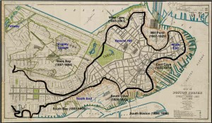
Annotated 1895 Boston Map Illustrating Landfill Projects

Select your language to auto-translate:

EnglishEspañolFrançaisDeutschItalianoDansk中文(简体)中文(漢字)日本語한국어PortuguêsTürkçeالعربية

One of the most fascinating and overlooked aspects of Boston is how much the land-form has changed over the years.  What you experience today is over 50% landfill.  Places you walk, such as the area around Faneuil Hall, were actually part of the harbor when Boston was founded in 1630.

When the first visitors arrived, they found a salamander-shaped, rocky, hilly, peninsula that was formed by erosion at the end of the last ice age.  Called Shawmut by the Native Americans, it was small, two miles long and only a mile wide.  It’s only connection to the mainland was the low-lying, narrow, wind-swept Boston Neck, which often flooded at high tide and was impassable during stormy weather – meaning the peninsula became an island.  During the siege of Boston, the British troops were effectively blockaded into this tiny island, without adequate food or firewood.

The peninsula was dominated by three hills, hence its early name of Trimountaine, which was later shortened to Tremont – a name that lives on in today’s Tremont Street. There was Copp’s Hill (in the North End), Beacon Hill (which had three summits and was almost twice as high) and Fort Hill (which was located in today’s financial district).

[embedplusvideo height=”365″ width=”450″ standard=”http://www.youtube.com/v/y3QlGzJW27c?fs=1″ vars=”ytid=y3QlGzJW27c&width=450&height=365&start=&stop=&rs=w&hd=0&autoplay=0&react=1&chapters=&notes=” id=”ep8086″ /]


Today’s Boston was created by a series of land reclamation projects, which started in a small way soon after the Puritans arrived in 1630 (you can see the 1630 water line marked in the pavement near the Samuel Adams Statue behind Faneuil Hall).

The major landfill projects took place between 1807 and about 1900, although some reclamation projects extended until almost 2000. Much of the land for the early projects came from the leveling of Fort Hill and from Beacon Hill. The largest project, the filling in of the Back Bay took, spanned several generations between 1856 and about 1894. For that project, gravel was transported in on a specially built train line from Needham, a suburb about nine miles away.  One of the first of the second generation steam shovels was used to fill the gravel cars for the trains, which ran around the clock for almost fifty years.

For a fantastic website, which was used to create the animations in the video above, visit the Boston Atlas. It is simply the best place to play with Boston’s changing topography, and was a great source for this post. Also visit the Norman B. Leventhal Map Center at the Boston Public Library – a wonderful source of historic Boston maps, many of which were used in the creation of this post and the accompanying video.  For those interested in learning more, there is another interesting post from Professor Jeffery Howe at Boston University; for that post, click here.

Divine Paradox at King’s Chapel: the Puritan – British Disputes & Role Reversals

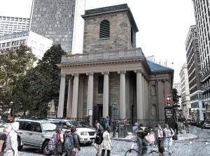
King’s Chapel

Select your language to auto-translate:

EnglishEspañolFrançaisDeutschItalianoDansk中文(简体)中文(漢字)日本語한국어PortuguêsTürkçeالعربية

It is universally acknowledged that the Puritans who founded Boston in 1630 left England fleeing religious persecution from the Anglican Church majority (Anglican was England’s official state religion). But the religious freedom they sought was self-centered; they did not seek universal religious tolerance, but rather freedom to practice their own brand of Protestantism (which became Congregationalism), and to build a closed religious-political society around it. Nowhere was this more visibly noted than in US President William Howard Taft’s 1909 address, where he said “We speak with great satisfaction of the fact that our ancestors – and I claim New England ancestry – came to this country in order to establish freedom of religion,” declared Taft. “Well, if you are going to be exact, they came to this country to establish freedom of their religion, and not the freedom of anybody else’s religion.”

In Puritan New England, citizens had to conform to the Puritan religion and rules, or they were at best second class citizens. Those who did not accept the constraints were prosecuted, often ruthlessly. Roger Williams (in 1635) and Anne Hutchinson (in 1638) were both banished over what today would be considered trivial infractions, but at the time were considered heretical. Later, the Puritans tried to peaceably drive out the Quakers, but when peaceable means failed, whipping and execution followed. Catholics were treated little better and were universally hated and harangued. Only members of the Puritan church could hold office, vote, or even own property. And, the Puritans ability to operate in this manner – largely free from normal English oversight and freedoms – was guaranteed by a unique Royal Charter which gave them significantly more autonomy than was enjoyed by other English colonies.

But, the most intriguing conflict was between the Puritans and their Anglican fellow Englishmen. Even though they professed loyalty to the Crown, the Puritans despised the Anglicans, resisted their involvement in New England’s political affairs, and actively fought the establishment of Anglican houses of worship. One of the key issues was that the Anglican form of Protestantism was much closer to the hierarchical ornateness and ceremony of Catholicism than the ascetic, Calvinistic Congregationalism, the defining standard of Puritan society. Even though Puritan government was open only to Church members, it had a representative assembly and established the Town Meeting management process, with relative autonomy and decision authority given to the local church and town.  This is a sharp contrast to the hierarchical British Royal/Parliamentary system, where power was held centrally. The Puritan New Englanders did their best to avoid English meddling or oversight for as long as possible; and they managed to do this for almost fifty five years.

No place in historic Boston does the Puritan:Anglican struggle better play out than with King’s Chapel, the first official Anglican congregation in Boston (King’s Chapel is Stop 4 on Boston’s Freedom Trail and can be visited on the corner of Tremont and School Streets).  Anglicans were present in Boston from the beginning, but they were second class citizens without many rights. As early as 1646, Anglican Dr. Robert Child and several others sent a “Remonstrance and Petition” to the Massachusetts General Court, claiming among other things, that they were not free to pursue their religion. In response, the Court admonished and fined them – e.g., their request was summarily rejected. In 1662, a letter from King Charles II to the colony was direct in requiring that “the freedom and liberty should be duly and allowed to all such as desired to use the Book of Common Prayer, and perform the devotions in the manner established in England, and that they might not undergo any prejudice and disadvantage…” The King’s letter was ignored. In a 1664 follow-up, Royal commissioners were sent to Boston to see that the King’s instructions were followed. This delegation also was ignored and King Charles became too involved with issues in Europe to pursue it further.

Finally, in 1676, to follow-up on multiple complaints, King Charles sent Edward Randolph to Massachusetts to investigate. His reports to the King and key ministers clearly noted, along with many other issues, the religious persecution of Anglicans, and included a discussion of British subjects being put to death for religious reasons and the Puritan laws against the celebration of Christmas. Randolph’s campaign against New England ultimately led to the revocation of the Massachusetts Charter in 1684, and the installation of Sir Edmund Andros as Governor in 1686.

King’s Chapel was officially established by the authority of the Lord Bishop of London in mid-1686. The first public service was conducted at the Boston Town House (the precursor of the Old State House) in June, and the official “King’s Chapel” congregation was established soon thereafter. But, the congregation did not have a chapel, and use of the Town House was inappropriate. The same day as his arrival in Boston in December of 1686, Governor Andros started aggressive steps to find a suitable place for worship. Rebuffed by peaceable requests to share space in one of the Puritan meeting houses, in March Andros demanded the keys to Old South Meeting House and commandeered the building for Anglican services – from this point, the building would be shared by both congregations, with priority going to the Anglicans. His requests for land on which to build an Anglican Chapel rebuffed, Andros sized a portion of the town’s burying ground, had the bodies moved, and a Chapel started. The original wooden King’s Chapel was ready in 1689, and the Old South congregation returned to their normal service schedule.

The current granite chapel was started in 1749 when the original became too small. The new chapel was built around the old wooden one so as not to disturb the services. But more importantly, Puritan and Bostonian law also indicated that if the walls were knocked down, the land would revert back to Puritans control. When the new chapel was finished, the old one was dismantled and tossed out through the windows, boxed up and sent to Halifax, where it was reassembled. The new chapel opened for services in 1754.

King’s Chapel Interior

Far more opulent than austere Congregationalist meeting houses, King’s Chapel was the recipient of many lavish gifts from the British monarchy. King William III and Queen Mary II (1689 – 1702) sent money, communion silver, altar cloths, carpets and cushions. Queen Anne (1702 – 1714) gave vestments and red cushions. King George III (1760 – 1820) donated more silver communion pieces. The silver pieces vanished when over half of the parishioners fled (they were Royalists) when the British left after the Siege of Boston was lifted in 1776.

As the first Anglican foothold in Boston, King’s Chapel presents a number of fascinating and almost poetic paradoxes relating to the Puritan:Anglican conflict. George Washington attended two services at the Chapel: the first in 1753 when he was a British Colonel and guest of Royal Governor Shirley, and second when he was President of the United States in 1789 – he sat in the “Governor’s Pew”. As a replacement for some of the silver that vanished in 1776, Paul Revere crafted several new silver pieces for the congregation as thanks for King’s Chapel hosting the belated funeral for Doctor/General Joseph Warren in April of 1776; Warren died at the Battle of Bunker Hill in June of 1775. Finally, and to come full circle, King’s Chapel became the temporary home for the Old South Meeting House congregation, whose meeting house was undergoing repairs; Old South had been so emblematic of the Patriot cause that during the Siege of Boston, the British ripped out the pews and pulpit, used them for fuel and turned the vacant meeting house into a stable and riding school for British cavalry. The Old South Congregation held services at King’s Chapel for five years, much longer than the King’s Chapel parishioners had held the keys to Old South.

In 1782 the remaining Chapel’s parishioners (there were many Anglicans who were Patriots, not Loyalists) resumed regular services; and in 1787, the first Anglican church in Massachusetts became the first Unitarian church in America. Today, the Church is an independent congregation affiliated with the Unitarian Universalist Association (which in New England was largely an outgrowth of Congregationalism), but offers a unique liturgy that combines Unitarianism with Anglican traditions. Perhaps this now represents the fitting marriage of Puritan and Anglican traditions and cultures. Huzzah, or perhaps Hurray!
 

Long Wharf – the Heart of Colonial & Revolutionary Boston

Select your language to auto-translate:

EnglishEspañolFrançaisDeutschItalianoDansk中文(简体)中文(漢字)日本語한국어PortuguêsTürkçeالعربية

From the beginning, Boston was a town linked to the sea, with its success dependent on maritime trade and industry. And, its most important gateway to the sea in colonial times was Long Wharf. Originally called Boston Pier, Long Wharf construction began in 1711 (when Boston was the largest city in the Colonies), completed by 1715, and at its peak was almost 1,600 feet in length, 54 feet wide, and capable of docking up to 50 vessels. It was, by far, the largest and most significant wharf in Boston and was to play a major role in Boston’s economic and Revolutionary history.

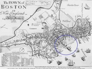
Bonner’s 1722 Map illustrating Long Wharf & the Old State House

The heart of Colonial Boston was the Town House, Boston’s official town hall, which was at the base of King Street (King Street’s name was changed to State Street after the Revolution). The first Town House was built in 1657 and burned down during the Great Fire of 1711. It was replaced by the current “Old State House” in 1713, and was the location for the British Government until they evacuated Boston 1776. From the Town House, a viewer could look directly down King Street to the end of Long Wharf, see ships coming and going, and keep the pulse of the town.

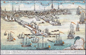
Paul Revere’s 1768 Engraving of British Troops Landing on Long Wharf

As illustrated in the famous Paul Revere engraving above, British Troops landed on Long Wharf to help enforce the Townshend Acts in 1768. The oldest structure remaining on Long Wharf today, dating from around 1760 is a building that served as John Hancock’s “counting house” (primary place of business), who in, addition to being the famous signer of the Declaration of Independence, was one of the richest men and a leading merchant in Boston. Today John Hancock’s counting house is the Chart House restaurant.

British troops departed from Long Wharf when they left Boston in March of 1776. It was the landing place for the ship from Philadelphia bringing the Declaration of Independence (first read to the citizens from the balcony of the Old State House on July 18the 1776), privateers and blockade runners sailed from its docks, and its warehouses held military stores.

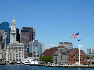
Water Shuttle Landing on Long Wharf

Today, Long Wharf is a great place to gather tourist information, take cruises of the harbor, and is the docking location for the water shuttles to the harbor islands and the Charlestown Navy Yard (USS Constitution). For an excellent posting on Long Wharf from a series by the National Park Service on maritime Boston, click here. The Aquarium is located at the end of Long Wharf.

Prospect Hill – Key Fortress in the Patriot Lines

Select your language to auto-translate:

EnglishEspañolFrançaisDeutschItalianoDansk中文(简体)中文(漢字)日本語한국어PortuguêsTürkçeالعربية

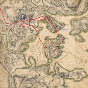
When on the night of April 18th the British left Boston on their fateful expedition to capture Patriot munitions in Concord and the “shot heard round the world,” they marched by a hill just outside of Union Square, in what today is the city of Somerville. In 1775, Somerville was part of Charlestown and was located “just beyond the neck” that separated the Charlestown peninsula from the mainland. The hill is called Prospect Hill, and it was to play a key role in America’s fight for freedom from Great Britain.
In the British retreat back to Boston on April 19th, they diverted to go via Charlestown and they again passed by Prospect Hill, but this time in hurried flight and under constant fire from American militia that had gathered from over 30 miles away. (Prospect Hill was one of the last landmarks to pass before the British could reach sanctuary in Charlestown.) There was a major skirmish at the foot of the hill, leading to death on both sides. At the end of the day, American troops were posted on the hill to observe the British as they ferried troops across the harbor between Charlestown and Boston.

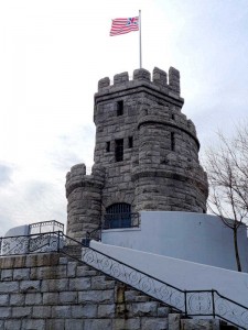
Two months later, immediately after the Battle of Bunker Hill, Prospect Hill was the sight of major American fortification and became the central position of the Continental Army’s chain of emplacements north of Boston. Its height and commanding view of Boston and the harbor had tremendous strategic value and the fortress became known as the “Citadel”.

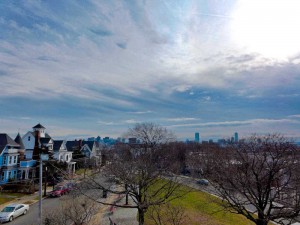
On July 1st, 1776, George Washington had the new “Grand Union Flag,” the first official flag that represented the united colonies, raised at the top of the Hill. It combined the familiar British Union Flag with 13 red and white stripes. (It was not until 1777 that the more familiar flag with stripes and thirteen stars was adopted.) During the winter of 1777-8, after his defeat at Saratoga, General Burgoyne and 2,300 of his troops were housed as prisoners of war in barracks on the hill.In 1903, a castle shaped monument was erected at the sight of the primary American fortifications. Today, the view of Boston and the surrounding towns is still impressive.

View Prospect Hill – Site of Fighting and Patriot Fortifications in a larger map

Jason Russell House – Site of the Bloodiest Fighting in the Battles of Lexington & Concord

Select your language to auto-translate:

EnglishEspañolFrançaisDeutschItalianoDansk中文(简体)中文(漢字)日本語한국어PortuguêsTürkçeالعربية

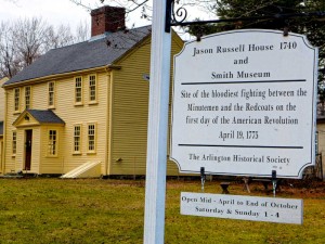
Arlington, then known by the Native American name of Menotomy, was the sight of the most intense fighting during the British retreat after the Battles of Lexington and Concord. About half of those who lost their lives, about 25 of the Americans and 40 of the British, died in Arlington. Of the American causalities, about half of the deaths took at the Jason Russell House.

The house was built by Jason Russell between 1740 and 1745, but had been doubled in size by the time of the 1775 battle. As it is located on Concord Road (now Massachusetts Avenue), the main street connecting Cambridge and Concord, it was strategic and was gathering site for Minute Men, as well as Jason and some of his neighbors, who wished to contest the British retreat. At the time the British were passing, about two dozen men had gathered around the Russell house and created a mini-fortress.

Although the group had effectively fortified themselves to be able to take pot shots at the main British column marching down Concord Road, they left themselves open to the flankers, who caught them by surprise. Trying to reach sanctuary in his house, Russell was shot down and died on his doorstep. Eight Patriots were cornered and bayoneted. About eight other Patriots effectively barricaded themselves in the basement. Although there were multiple British casualties, a total of twelve Patriots died in and around the Russell house – making this the bloodiest spot in a bloody day.

Bullet holes can still be seen in several parts of the house, which is open for visitors and part of the Arlington Historical Society. There is a wonderful and detailed write-up of the house and its history as part of the Historic New England’s Old-Time New England Articles section, available here.


View Jason Russell House – Site of the Bloodiest Fighting in the Battles of Lexington & Concord in a larger map


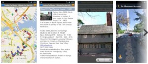
Freedom Trail Map & Tour App w/Auto Translate – Free!

Freedom Trail Boston Map & Tour App


The Freedom Trail Map & Touring App is now available on Google Play as well as Amazon  It is based on the interactive Google Map created for the Freedom Trail Boston – Ultimate Tour Guide – Tips, Secrets & Tricks eBook.

Select your language to auto-translate:

EnglishEspañolFrançaisDeutschItalianoDansk中文(简体)中文(漢字)日本語한국어PortuguêsTürkçeالعربية

The app is much faster and easier to use than the browser version and it exposes all the most powerful features of Google Maps including street mode, local search, directions, and local transportation information. The map itself contains all 16 official Freedom Trail Stops and over 50 additional interesting sites on or close to The Freedom Trail.

An innovative ability for international travelers is the web-based auto-translate feature.  By selecting auto-translate on selected map entries, users with internet-access will access a web site where they can elect to read the entry in Spanish, French, German, Japanese, Mandarin, Korean and other languages.

The app is the perfect companion for planning or when walking The Freedom Trail.

What is The Freedom Trail?

Freedom Trail Logo Boston

Welcome to The Freedom Trail

The Freedom Trail is the largest attraction in New England, with over three million visitors a year. It is fun, walkable, accessible, family-friendly, engaging, and a bargain. You can see it in 1/2 a day, or spend several days and still want more.

Select your language to auto-translate:

EnglishEspañolFrançaisDeutschItalianoDansk中文(简体)中文(漢字)日本語한국어PortuguêsTürkçeالعربية

And, Boston has everything you might want in a destination – world class museums, fantastic restaurants, shopping, sports, music, theater and history. It’s a unique and charming place that can feed almost any passion. There are great options for almost any budget, even a bargain lobster lunch.

So, what is it? The Freedom Trail is a 2.5 mile red brick path  (mostly brick – some lines are painted) that connects 16 significant historic sites, referred to as “Stops” throughout this blog.  The Trail starts at Boston Common and officially ends at the Bunker Hill Monument in Charlestown.

Most of the Stops are free and many are handicapped accessible, but some may be difficult to navigate for non-walkers. For the few that charge admission, there are discounted tickets available.

The original idea for The Freedom Trail was conceived by William Schofield, a long-time journalist for the now defunct Boston newspaper, the Herald Traveler. In 1951, Schofield had the idea for a walking path that connected Boston’s great collection of local landmarks. With the support of local historians, politicians and businessmen, the Freedom Trail was born.

In addition to the official Stops, there are many “unofficial Stops” you pass as you traverse the Trail, or are very near by. Most unofficial Stops are directly associated with Revolutionary Boston and The Freedom Trail, but some are simply interesting places.  Many folks include them in their Freedom Trail visit.

So, how should you plan for your visit, and for how long? The posts on Planning to Tour, Part 1 and Part 2, will give you an overview of all the official Stops, a sense of how long it takes to visit each, and alternative itineraries for 1/2, full and two day tours. Use this free custom Google Map to help visualize your visit – it is practically a full blown self-touring guide in itself. For a complete view of The Freedom Trail, get a copy of the “Freedom Trail Boston – Ultimate Tour & History Guide – Tips, Secrets & Tricks“.

The influence Boston had on the thinking and actions that led to the American Revolution was extraordinary. Without Boston and its unique history, the American colonies break with Great Britain may have still happened, but not when and how it did. The Freedom Trail presents the essence of Revolutionary Boston and brings its amazing impact to life.

Enjoy, Boston is a unique city and The Freedom Trail is a national treasure.

The Freedom Trail Tour Planning – Part 2

In Part 1 of this series, I provided an assessment for the time needed to visit each of the 16 official Freedom Trail Stops. In this post, I’ll suggest itineraries for 1/2, full and two day tours. If you can, plan for a full day (or more), especially if you want to spend time visiting any particular Stop. However, if it’s all you have, a 1/2 day is still fantastic, and it takes two days for an in-depth visit.

Select your language to auto-translate:

EnglishEspañolFrançaisDeutschItalianoDansk中文(简体)中文(漢字)日本語한국어PortuguêsTürkçeالعربية

Below find alternatives for 1/2 day, full day and two day visits. Use the custom Google Map referenced here to help you visualize what you are seeing and help as you walk your tour.

Most of the downtown Stops are close together. Walking directly from Boston Common (Stop 1) to Faneuil Hall (Stop 11) is only about .6 miles (1 km) and takes less than 15 minutes. Walking from downtown Faneuil Hall to the Paul Revere House in the North End (Stop 12) takes 10-15 minutes, but you pass through the Blackstone block, one of my favorites and a great place for a lobster lunch.

The Charlestown Stops (USS Constitution and Bunker hill) are another 15+ minute walk from the last Stop in the North End (Copp’s Hill Burying Ground), and there is a 10+ minute walk between the USS Constitution and Bunker Hill. If you can, save energy for the climb up the Bunker Hill monument, the view from the top is spectacular on a nice day.

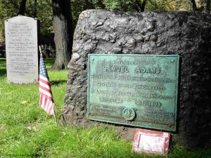
Sam Adams & Boston Massacre Victims in Granary Burying Ground

Sam Adams & Boston Massacre Victims in the Granary Burying Ground

To review, the official stops are:

Stop 1 – Boston Common.

Stop 2 – The Massachusetts State House.

Stop 3 – Park Street Church.

Stop 4 – Granary Burying Ground.

Stop 5 – King’s Chapel.

Stop 5a – King’s Chapel Burying Ground.

Stop 6 – Boston Latin, Old City Hall, Franklin Statue.

Stop 7 – Old Corner Book Store.

Stop 8 – Old South Meeting House.

Stop 9 – Old State House.

Stop 10- Boston Massacre Site.

Stop 11 – Faneuil Hall and National Park Service visitor center.

Stop 12 – Paul Revere House.

Stop 13 – Old North Church.

Stop 14 – Copp’s Hill Burying Ground.

Stop 15 – USS Constitution and the Charlestown Navy Yard.

Stop 16 – Bunker Hill Monument.

1/2 Day Tour Recommendations:

Option 1: (Downtown) Walk by Stops 1 – 3, visit Stops 3 – 5, walk by 6-8, visit 9, walk by 10, and visit 11. Lunch and break at Faneuil Hall Market or the Blackstone Block area.

Option 2: (Downtown and North End): Walk by Stops 1 – 3, visit Stops 3 – 5, walk by 6 – 10, visit 11, walk by 12, visit 13 and 14. Lunch and break in Faneuil Hall Market, the Blackstone Block or the North End.

Option 3: (Charlestown – USS Constitution and Bunker Hill): Visit Stop 15 USS Constitution (bypass the Constitution Museum and USS Cassin Young), visit Bunker Hill Monument and Museum. Lunch at the Warren Tavern or at the Navy Yard.

Option 4: (Charlestown, USS Constitution): Spend a full 1/2 day visiting the USS Constitution, the Museum, USS Cassin Young and walk around the Navy Yard. Lunch at the Navy Yard or across the Bridge in the North End.

Option 5: (A little Downtown, free ranger-guided tour, North End, USS Constitution – requires a lot of walking and tour-time coordination): Start at Stop 11, Faneuil Hall, and listen to the NPS Great Hall talk, take the NPS  tour that goes to the North End, visit Stops 13 – 15, take the Water Shuttle back to Long Wharf.

Full Day Tour Recommendations:

Boston and the North End: Walk by Stops 1-3, visit Stops 3-5, walk by 6-7, visit 8 and 9, walk by 10, visit 11, lunch or break in Faneuil Hall Market, the Blackstone Block or the North End, visit 12-14.

Charlestown: spend a full 1/2 day visiting the USS Constitution, the Constitution Museum, USS Cassin Young and walk around the Navy Yard, lunch around the Navy Yard or at the Warren Tavern, visit the Bunker Hill Monument and Museum.

If you want to visit the entire Freedom Trail in a single day, it is recommended that you combine Options 2 and 3. It will be busy and there is a lot of walking, but you will have a great time.

Two Day Recommendations:

For a two day visit, combine both of the full day recommendations. It is worth the time if you can spare it.

What would I do?

If I could fit in a flexible half day, especially with kids, without question Option 5. This requires planning to fit in the National Park Service ranger tours, but is absolutely worth it. Start at Faneuil Hall  and enjoy the Great Hall ranger talk (every 1/2 hour) and get a sticker for the ranger-tour that goes to the North End (currently at 12, 2 & 3 PM – stickers available 1/2 hour prior. Confirm times at the NPS visitor center.) After the tour, visit Old North Church (Stop 13), walk through Stop 14, then walk quickly to Stop 15 and take the USS Constitution tour. Take the Water Shuttle back to Long Wharf (every 1/2 during non-commuting hours). Grab lunch where you can.

If I only had half a day, wanted to self-guide, and could not coordinate times for Option 5, I’d recommend Option 2 with a lobster lunch in the Blackstone Block. See as much as you can, and the North End has fantastic character and European feel. Don’t miss a Faneuil Hall tour or visiting the Old State House. If you are not from New England, the lobster is not to be missed.

If I had a full day, combine Options 2 and 3. The downtown stops are great and I love the Navy Yard and USS Constitution (it is easy to spend too much time here). Bunker Hill and the Bunker Hill museum are excellent. Have a lobster lunch in the Blackstone Block or grab some character and a Paul Revere Burger at the Warren Tavern in Charlestown (I’d choose the lobster, but it may be too early in your day).

Have a great visit.

The Freedom Trail Tour Planning – Part 1

Select your language to auto-translate:

EnglishEspañolFrançaisDeutschItalianoDansk中文(简体)中文(漢字)日本語한국어PortuguêsTürkçeالعربية

The entire Freedom Trail is only 2.5 miles long, but seeing it all in one day is difficult,  especially if you want to spend time visiting any particular Stop. To help you plan your visit, I’ve provided a quick assessment for each of the official 16 Stops, its significance to the Revolutionary period, and the recommended time needed for a visit. Where relevant, I’ve also mentioned unofficial Stops you will pass along the way.

In Part 2 of this series, there are specific recommendations for 1/2, full and two day tours. Use this custom Google Map to help visualize and plan your tour.

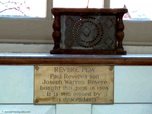
Paul Revere Pew in Old North Church

Revere Pew in Old North Church

Stop Review:

Note: Most of the downtown (Stops 1 through 11) are close together. Walking directly  from Boston Common to Faneuil Hall is only about .6 miles (1 km) and takes less than 15 minutes.

Stop 1 – Boston Common. A great old park, but unless you want to walk around the park and enjoy the outdoors, there is not much of prime historical importance to see. There is a good playground for younger children at Frog Pond.

Stop 2 – The Massachusetts State House. There are excellent guided tours and it is a fascinating and elegant old building, Plan 1.5-2 hours to pass through security and take the tour. While it is worthwhile, there is not much relating to the Revolutionary period as the State House was built after the Revolution. Take the time to view St. Gauden’s Robert Gould Shaw & MA 54th Memorial across the street at the edge of Boston Common.

Stop 3 – Park Street Church. Closed for viewing except during the summer. Unless you take a tour, it will not take much time. There is little of primary Revolutionary significance.

Stop 4 – Granary Burying Ground. This is the final resting spot for Sam Adams, John Hancock, Paul Revere, Mother Goose, the Boston Massacre victims, and others. Plan about 15 minutes to walk through.

Stop 5 – King’s Chapel. Great old church usually open for viewing. Plan 15 minutes to walk through.

Stop 5a – King’s Chapel Burying Ground. The oldest in Boston, plan about 10 minutes to walk through and view the old stones. Not much of Revolutionary significance as the Burying Ground was full well before 1700.

Stop 6 – Boston Latin, Old City Hall, Franklin Statue. Everything is outside (there is no interior viewing of Old City Hall). Plan 5-10 minutes to view the outside plaques.  If you want to see the Province House steps, plan for another 5 minutes to walk up Province Street.

Stop 7 – Old Corner Book Store. You will walk by and see the house, which now houses a Chipotle Mexican Grill. Nothing to tour.

Stop 8 – Old South Meeting House. Plan 1/2+ hour to view inside and the exhibits. The Meeting House is interesting given the number of important Revolutionary-era meetings that took place here. There are interpretive exhibits that place the building and its events in history and a good three dimensional map of Revolutionary-era Boston that highlights key locations – fascinating given the city’s changing topology. Check their web site for other programs. Benjamin Franklin’s birthplace and the Irish Memorial are directly across the street and are quick to see.

Stop 9 – Old State House. The Old State House features excellent docent-given tours and talks that cover the building and Revolutionary events. The museum has some good displays and exhibits. Plan about an hour to visit and take a tour. Highly worthwhile.

Stop 10 – Boston Massacre Site. This is a plaque embedded in the street directly below the balcony of the Old State House. This is a walk-by with a photo opportunity.

Stop 11 – Faneuil Hall. This is a great old and important building. Go inside and enjoy a Ranger-led talk (given every 30 minutes). Plan for 30-45 minutes to visit the Hall. The Faneuil Hall Marketplace (Quincy Market) is located next door, and is a good place to stop, get something to eat or shop. Plan accordingly. The new National Park Service visitor center is located in the first floor of Faneuil Hall.

Note: From Faneuil Hall, it is a 15 minute walk to the next official Stop, the Paul Revere House, in the North End. On the way, you pass some interesting unofficial Stops in the Blackstone Block area – the Holocaust Memorial, Union Oyster House, Marshall Street, and the Ebenezer Hancock House. The Blackstone Block is also a good, less commercial place to take a break or to eat. Some of the local restaurants feature good lobster specials at lunch.

Stop 12 – Paul Revere House. Built in 1680, it is the oldest structure remaining in Boston. It is a good example of a period dwelling and you will gain insights into Paul Revere’s life. The costumed docents provide interesting descriptions of the house and the Revere family. Visiting is worthwhile, but the house is small, consisting of only four rooms. Plan for about 1/2 hour.

Note: It is about a 10 minute walk through the North End to the next stop. The North End is also an excellent place to stop for lunch. It has a very European feel and many wonderful restaurants.

Stop 13 – Old North Church. A beautiful and important church, the oldest remaining in Boston. A walk through takes about 15 minutes. Purchase the $1 pamphlet that illustrate the highlights.

Stop 14 – Copp’s Hill Burying Ground. An 5 minute walk up hill from the Old North Church. Plan about 10-15 minutes to walk through the Burying Ground. There are a few interesting graves, a headstone used by the British for target practice, and a nice view of the harbor.

Note: From here there is another 15+ minute walk across the bridge to Charlestown and the next Stop, the USS Constitution.

Stop 15 – USS Constitution and the Charlestown Navy Yard. Visiting the Constitution and the Museum can easily be a half day visit. For the Constitution alone, plan at least an hour to pass through security, view the small museum and take the guided tour of the ship. The very good USS Constitution Museum (different from the small museum attached to the Constitution), is worth another hour. A walk around the USS Cassin Young will take another 1/2 hour. Walking around the Navy Yard area is also a pleasure, and there are a few restaurants in the neighborhood. This is a highly worthwhile 1/2 day, especially for children, who will enjoy exploring the ships.

Note: There is another 15 minute walk between the Charlestown Navy Yard and the Bunker Hill Monument and Museum. For a historic lunch, try the Warren Tavern, which is only a short detour between the two sites.

Stop 16 – Bunker Hill Monument. To tour the monument area, plan about 15-20 minutes, unless you plan to make the 294-step ascent to the top. That is a fun activity and provides a spectacular view of Boston and the surrounding area. If climbing the Monument, plan 1/2 hour. To visit the Bunker Hill Museum, which is excellent and best seen before the monument, plan another 1/2 to full hour. The museum features exhibits on the battle and Charlestown history, and has ranger-guided programs – great for children. If you have time, visit the Museum before the Monument. Highly recommended.

Freedom Trail Boston Video Virtual Tour in 5 Minutes

A 5 minute comprehensive video walk through of The Freedom Trail, it features all the 16 official Freedom Trail Stops, more than 50 unofficial Stops, historic restaurants, and other interesting places in and around The Freedom Trail – all included in theFreedom Trail Boston – Ultimate Tour Guide – Tips, Secrets & Tricks eBook. It moves fast as it contains almost 150 photos and video segments, so keep your pause key handy if you want to view anything in detail. A must see for anyone visiting The Freedom Trail and Colonial Boston.

The video was created as a companion to the  eBook “Freedom Trail Boston – Ultimate Tour and History Guide,” now available on Amazon.com. The Guide covers all of the sites in the video and more. In addition to any touring information the reader might need, the Guide provides detailed historical context from the time of Boston’s founding through events like the Boston Massacre, the Boston Tea Party, Paul Revere’s Ride, the Battles of Lexington and Concord, and the Charles Bulfinch era. In short, it contains everything someone might want to know to visit and enjoy The Freedom Trail and Revolutionary Boston.

For a companion map to the video, see my custom Google Map posting. The map includes everything in the video.

Enjoy the video!

Freedom Trail Maps with Google Map Tour

Any visitor to the Freedom Trail and Colonial Boston will need good maps.  Here are several – all free.

The Google map below was created for the eBook Freedom Trail Boston – Ultimate Tour and History Guide. In itself, the map is almost a full tour guide and includes the essentials for all the official, as well as many interesting unofficial Freedom Trail sites. All of the Official Stops come with web-based auto-translate links that allow the user to specify the language for the post. A great feature for non-English comfortable users.

The map also provides information such as operating hours, websites, phone numbers, admission costs and handicap access notes.  There are even listings for the best historic restaurants. Here is a video post that includes all the sites listed in the map.

The map is also available as a FREE full-blown Android app, downloadable from Google Play as well as from the Amazon App Store. The app exposes all the best features of Google Maps and is, by far, the most usable way to use the map. It  performs better than using a browser, is much less awkward, and lets you keep the map easily identifiable and ready to launch.

Use it (at your own risk as travel information is subject to change), enjoy it, and please comment.  Pass the link on to your friends.

View Freedom Trail Map & Historic Boston Guide in a larger map


Next is a series of official Freedom Trail maps from the US National Park Service (NPS).  These are savable, printable,  well done and all paid for by US tax dollars.

The main Freedom Trail Map, which is the same that you will see on the NPS Freedom Trail Guide paper guide, is available here.  It is also available from The Freedom Trail Foundation here.  Additionally, there are other relevant visitor maps available from the National Park Service – for the whole series click here.  In addition to the official Freedom Trail map mentioned above, there is a less detailed Freedom Trail map with an outline of Boston’s harbor line at 1775 – fascinating for historical context.  Click here for the 1775 overlay map.  The series also includes maps for the Charlestown Navy Yard,  Boston Harbor in WW II, a map that shows walking distances between Boston sites (Boston is a very walkable city), and a guide for tour bus parking.


Paul Revere, George Washington and John Adams Face to Face at Boston MFA

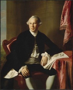
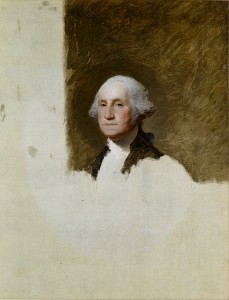
The Boston Museum of Fine Arts is awesome, and it’s the only place you can see some of the most influential leaders of the American Revolution up close and personal.  John Singleton Copley’s vivid and compelling portraits of Paul Revere, Sam Adams, John Hancock and Joseph Warren are intimate and perceptive.  Gilbert Stuart’s works of George Washington are superb, and you can even see the original portrait used as the model for the U.S. one dollar bill.  This is as close as you can get to shaking hands with these leaders of the American Revolution today.

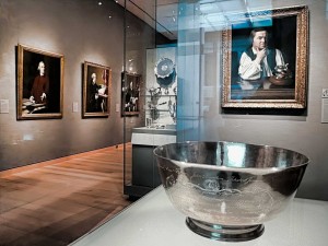
Revere’s Sons of Liberty Bowl with Copley’s Portraits of Revere, Samuel Adams, John Hancock, & Dr. Warren

Located on the first floor of the MFA’s Art of the America’s Wing, the first thing you meet upon entering the gallery is Paul Revere’s 1768 “Son’s of Liberty Bowl.” The silver bowl was commissioned by fifteen members of the Sons of Liberty to honor the Massachusetts House of Representatives for standing up to the British after the Townshend Acts in 1767.  The chain of events set off by the Townshend Acts, and the troops Britain sent to quell the associated Colonial turbulence, was to lead inexorably to the Boston Massacre in 1770 then on to the American Revolution.

The Townshend Acts taxed imported commodities, including paper, glass and tea.  The Massachusetts House of Representatives sent a “Circular Letter” to other colonies asking for their support to protest the Acts – which resulted in boycotts of British goods by Royal colonies.  In Boston, resistance was so intense that British custom officials requested military assistance.  After the HMS Rodney, a 50-gun warship, arrived in Boston harbor, the Colonials rioted and Britain sent 4 regiments of troops to restore order. The presence of the troops led directly to the Boston Massacre.

Directly behind the bowl is Copley’s 1768 portrait of Paul Revere, painted when Revere was thirty three years old.  The portrait was unusual for the period, as it shows Revere without the traditional gentleman’s coat and wig.  (Revere’s family thought it made him look like a workman and actually hid it in the attic.)  The portrait works on many levels, both as a discerning picture of Revere and as a political statement.  Note Revere’s flaunting display of flowing linen shirtsleeves – the linen was manufactured in Boston in direct defiance of British laws.   Flanking the portrait are two cases of Revere’s silver – incredible works of art on their own.

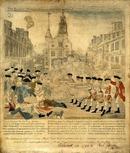
Paul Revere’s Engraving of the Boston Massacre

On the wall to the left of Revere’s portrait you will find four important Revolutionary works, one an engraving and three Copley portraits of Boston revolutionaries.  The engraving is Paul Revere’s highly sensationalized depiction of the March 1770 Boston Massacre.  The Massacre took place after an unfortunate chain of events led British soldiers to fire on an angry Boston mob, killing five and wounding six.  Although hardly a massacre (most of the soldiers were later acquitted of blame) it was to be an important event provoking colonial unrest.  The famous engraving you see was a key piece of Patriot propaganda used to help move America closer to its break with Great Britain.

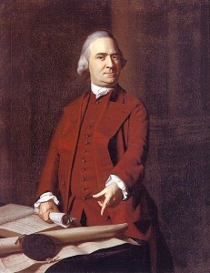
Sam Adams at 50 in 1772

Next is the 1772 portrait of Samuel Adams.  Adams is shown defiantly pointing to a petition from angry Boston citizens after the Boston Massacre.   The portrait was commissioned by John Hancock to hang in his Beacon Street mansion which was located at the southwest corner of the current Massachusetts State House site.

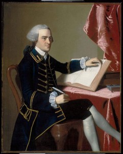
John Hancock at 28 around 1765

Next is John Hancock himself, painted in 1765 when he was twenty-eight.  Hancock is best known for his flamboyant signature on the Declaration of Independence, and he was a multidimensional architect of the Revolution.   A successful merchant, he was one of the richest people in America and personally funded much of the Boston-based dissension.  He was president of the Massachusetts Provincial Congress (the Patriot shadow government that was formed after the Boston Tea Party in 1774), the second Continental Congress, which created the Declaration of Independence, and later served as the first Governor of the State of Massachusetts.

Joseph Warren at 24 around 1765

Further down the wall is the sensitive portrait of Dr. Joseph Warren at the age of twenty-four, also painted around 1765.  Warren was one of the most influential Patriot leaders, and served as President of both the Massachusetts Committee of Safety and the Provincial Congress.   After the April 1775 Battles of Lexington and Concord, he strongly advocated going to war with Britain.  Even though he had limited military experience, he was appointed a major general.  He died fighting as a private during the Battle of Bunker Hill on June 17, 1775.   John Trumbull’s painting “The Death of General Warren at the Battle of Bunker’s Hill” is shown elsewhere in the exhibit.

The exhibition features a number of other Revolutionary-themed works including Copley’s 1796 portrait of John Quincy Adams, the son of John Adams and the sixth President of the United States, and John-Antoine Houdon’s 1789 portrait of Thomas Jefferson.

George Washington at 64 “The Athenaeum Portrait” – on the U.S. One Dollar Bill

The next exhibit room features some monumental works by Gilbert Stewart, including the 1796 unfinished portrait of George Washington, known as “The Athenaeum Portrait.”  This painting was used as a model for more than fifty other works, including the image on the U.S. one dollar bill.  Also displayed are Stuart’s portrait of Martha Washington and his idealized 1806 painting of Washington at Dorchester Heights.

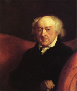
Other Revolutionary works in the same exhibit include Thomas Sully’s 1819 huge painting “The Passage of the Delaware” and Gilbert Stuart’s 1805 painting of General Henry Knox.  General Knox led the expedition that brought the cannons used to lift the Siege of Boston.  He then became chief artillery officer of the Continental Army and later Washington’s Secretary of War.  Stuart’s 1823 portrait of John Adams, ninety at the time of the painting, rounds out the exhibit.  Look into Adams’ tired, sensitive eyes.

Stuart’s John Adams at 90

In all, the five rooms of this gallery contain a treasure of colonial furniture as well as many other important paintings from the 18th and early 19th century colonial America.   Visit and enjoy, whether you are a Revolutionary War enthusiast or not.


Photos of Paul Revere Bowl and Gallery Entrance showing Paul Revere and other Copley portraits, stevestravelguide.com – all rights reserved.

Other pictures from Wikimedia Commons – these works are considered public domain in the United States, and those countries with a copyright term of the life of the author plus 100 years or fewer.


Boston Founding Enabled by Innovative 17th Century Corporate Buy Out

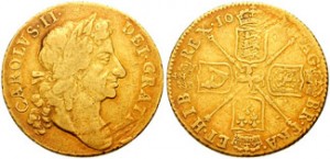
Guinea from reign of Charles II

As described in my entry on Henry VIII’s influence on the founding of Boston, life in the 1620’s England was becoming very difficult for English Puritans.  This was compounded by extremely difficult economic conditions in the areas of England many Puritans called home.

One group of Puritans, led by John Winthrop, a prosperous lord of the manor of Groton, East Anglia, decided it was time to leave.  Realizing that they were unlikely to receive a land grant from the King, they had to find a way to obtain a grant via non-traditional means.  And ideally, so they could build their ideal society, the land would be free from London’s interference in their affairs.  This was a tall order.

It turns out that in 1628, King Charles had given a royal land grant to the New England Company, who represented a group of merchants who wanted to establish mines and trading posts on the Atlantic coast.  The corporate rights of the New England Company were spelled out in the “Charter of the Colony of the Massachusetts Bay in New England.”  The Charter had a very interesting omission – it did not stipulate out where the governor (the equivalent of the modern day CEO) and his assistants (the board of directors and management team) were to hold their meetings.  At this time, it was standard operating practice for the management of a company to be in London, and the worker bees to be in the new world operating by remote control – across three thousand miles of stormy ocean.

The grant was for a substantial parcel of land that ran from the Merrimack River, about 40 miles north of Boston by modern day Newburyport, to the Charles River, which runs through Boston.  And, the parcel ran from “from sea to sea.”

In a move very unusual for this time period, Winthrop and his Puritan supporters bought out a controlling interest in the New England Company from the existing shareholders.  To assure themselves the ability to govern free from royal interference, they had the company transfer its management meetings from London to America.  Furthermore, they decided that only those people who were willing to leave England could become shareholders and required that existing shareholders who did not want to move to America sell their shares.  John Winthrop was elected governor and the entire operation, including the physical charter document, moved to America.

This land grant and its innovative corporate charter was the perfect vehicle to use as the foundation for the Puritans’ wide-reaching and ambitious social experiment in the new world.   It was to provide the foundation for the wide range of independent thought and action that was fundamental to the development of Boston and the philosophies leading to the American Revolution.

Guinea photo from the Classical Numismatic Group, GNU Free Documentation License, Version 1.2 or later.

Henry VIII’s Critical Influence on Boston’s Founding

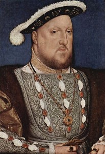
There is an amazing linkage between Henry VIII (king of England from 1509 to 1547) and the founding of Boston. In his quest to produce a male heir, Henry wanted to divorce his first queen, Catherine of Aragon. The pope refused to annul the marriage, so Henry drove what became known as the English Reformation (+/-1530) by which the Church of England broke away from the authority of the Pope and the Roman Catholic Church. (Henry’s motives were also political, but that is another story.)
When England broke with the Catholic Church, many different Protestant sects vied for power. After Henry’s death, his daughter, Queen Elizabeth I (the Virgin Queen, reigning 1558-1603), set out to eliminate the “foolish theological quibbling” among the Protestant sects by formalizing the Church of England (Anglican Church) as the official church and instituting Penal Laws to enforce compliance.
The Church of England retained many of the trappings and hierarchy of the Catholic Church, which many English Protestants abhorred. Some dissenters joined the Church of England and worked to “purify” the church from within, becoming known as “Puritans”. Some refused to join church, and became known as “Separatists.”
Elizabeth’s successors, James I (rule 1603 – 1625) and his son Charles I (rule 1625 – 1649), made things particularly uncomfortable for the dissenters and were zealous in enforcing conformity to the Church of England. The persecution inflicted on the non-conforming Protestant approaches prodded two key groups to leave England in search of religious freedom and found settlements important to Boston history.
The first group of dissenters were Separatists, who after departing England for Holland in 1608, left for America 1620 and founded Plymouth, about 40 miles south of Boston. This group was relatively poor and agrarian.
The second group was more affluent and included sophisticated merchants and businessmen. Led by John Winthrop, they sailed from England to New England in 1630 with the ambitious mission to create a new society, a “city upon a hill” (reference from Jesus’ Sermon on the Mount), that would be watched by the world. This new kind of society would balance both civil and ecclesiastical dimensions for the good of the public – guided by God and the Bible. This group landed near present day Salem, MA, about 20 miles north of Boston. They then moved south and founded Boston, named for a town near their home in Lincolnshire, England.
Would Boston have been founded if Henry had not wanted a male heir? Over time, there would have certainly been an important city at site of present-day Boston.  However, it would not have been called Boston, and it would not be close to the city we know. The Puritans, their culture, their society and even their form of governing was instrumental to the character of early Boston, the American Revolution, and lives on to this day. Thank you, King Henry.